You are here: Home > Network List > NE - New England Seismic Network Stations List
> Station PQI Presque Isle, ME, USA > Earthquake Result Viewer
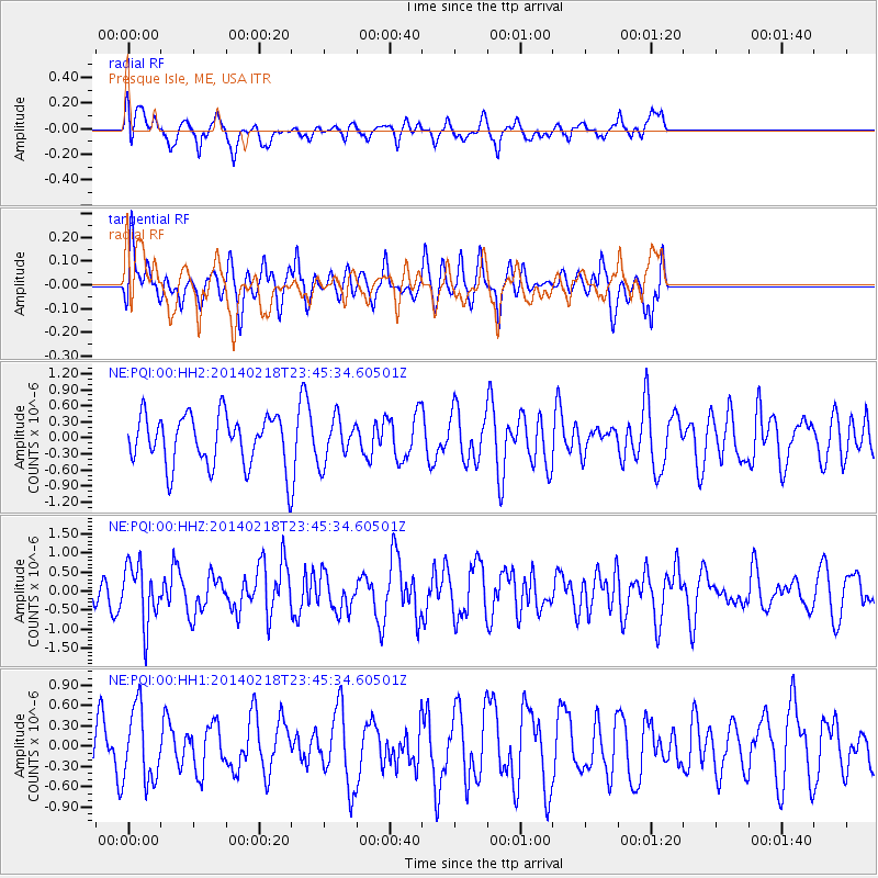
PQI Presque Isle, ME, USA - Earthquake Result Viewer
*The percent match for this event was below the threshold and hence no stack was calculated.
| Earthquake location: |
Near Coast Of Peru |
| Earthquake latitude/longitude: |
-14.2/-75.6 |
| Earthquake time(UTC): |
2014/02/18 (049) 23:35:58 GMT |
| Earthquake Depth: |
57 km |
| Earthquake Magnitude: |
6.0 MWB, 5.9 MWW, 5.9 MWC, 6.0 MWC |
| Earthquake Catalog/Contributor: |
NEIC PDE/NEIC COMCAT |
|
| Network: |
NE New England Seismic Network |
| Station: |
PQI Presque Isle, ME, USA |
| Lat/Lon: |
46.67 N/68.02 W |
| Elevation: |
162 m |
|
| Distance: |
60.9 deg |
| Az: |
5.968 deg |
| Baz: |
188.421 deg |
| Ray Param: |
$rayparam |
*The percent match for this event was below the threshold and hence was not used in the summary stack. |
|
| Radial Match: |
59.87966 % |
| Radial Bump: |
400 |
| Transverse Match: |
57.565975 % |
| Transverse Bump: |
400 |
| SOD ConfigId: |
626651 |
| Insert Time: |
2014-04-20 20:02:11.744 +0000 |
| GWidth: |
2.5 |
| Max Bumps: |
400 |
| Tol: |
0.001 |
|
Signal To Noise
| Channel | StoN | STA | LTA |
| NE:PQI:00:HHZ:20140218T23:45:34.60501Z | 2.1055636 | 7.7476784E-7 | 3.6796223E-7 |
| NE:PQI:00:HH1:20140218T23:45:34.60501Z | 1.2098662 | 5.4671233E-7 | 4.5187832E-7 |
| NE:PQI:00:HH2:20140218T23:45:34.60501Z | 0.86827767 | 4.0681894E-7 | 4.6853555E-7 |
| Arrivals |
| Ps | |
| PpPs | |
| PsPs/PpSs | |


