You are here: Home > Network List > PE - Penn State Network Stations List
> Station PAGS PA Geological Survey > Earthquake Result Viewer
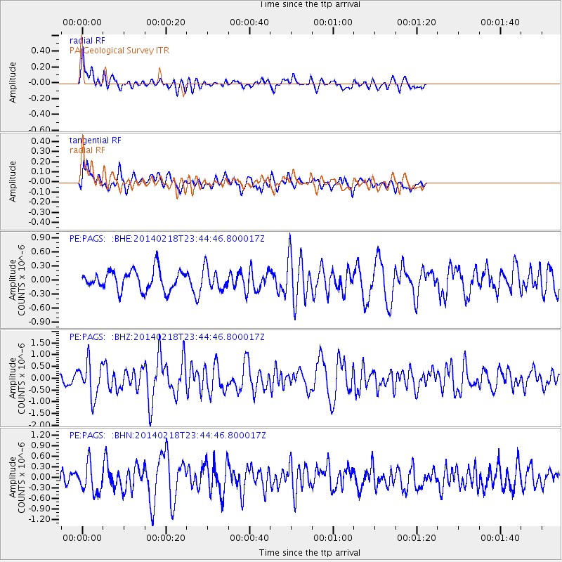
PAGS PA Geological Survey - Earthquake Result Viewer
*The percent match for this event was below the threshold and hence no stack was calculated.
| Earthquake location: |
Near Coast Of Peru |
| Earthquake latitude/longitude: |
-14.2/-75.6 |
| Earthquake time(UTC): |
2014/02/18 (049) 23:35:58 GMT |
| Earthquake Depth: |
57 km |
| Earthquake Magnitude: |
6.0 MWB, 5.9 MWW, 5.9 MWC, 6.0 MWC |
| Earthquake Catalog/Contributor: |
NEIC PDE/NEIC COMCAT |
|
| Network: |
PE Penn State Network |
| Station: |
PAGS PA Geological Survey |
| Lat/Lon: |
40.23 N/76.72 W |
| Elevation: |
120 m |
|
| Distance: |
54.1 deg |
| Az: |
358.942 deg |
| Baz: |
178.659 deg |
| Ray Param: |
$rayparam |
*The percent match for this event was below the threshold and hence was not used in the summary stack. |
|
| Radial Match: |
50.231808 % |
| Radial Bump: |
387 |
| Transverse Match: |
58.3144 % |
| Transverse Bump: |
400 |
| SOD ConfigId: |
626651 |
| Insert Time: |
2014-04-20 20:05:08.308 +0000 |
| GWidth: |
2.5 |
| Max Bumps: |
400 |
| Tol: |
0.001 |
|
Signal To Noise
| Channel | StoN | STA | LTA |
| PE:PAGS: :BHZ:20140218T23:44:46.800017Z | 2.6347547 | 7.496599E-7 | 2.845274E-7 |
| PE:PAGS: :BHN:20140218T23:44:46.800017Z | 1.4066393 | 4.162871E-7 | 2.9594446E-7 |
| PE:PAGS: :BHE:20140218T23:44:46.800017Z | 1.081843 | 2.2828122E-7 | 2.110114E-7 |
| Arrivals |
| Ps | |
| PpPs | |
| PsPs/PpSs | |


