You are here: Home > Network List > TA - USArray Transportable Network (new EarthScope stations) Stations List
> Station E54A Lac Daplat, Pontiac, MRC, QC, CAN > Earthquake Result Viewer
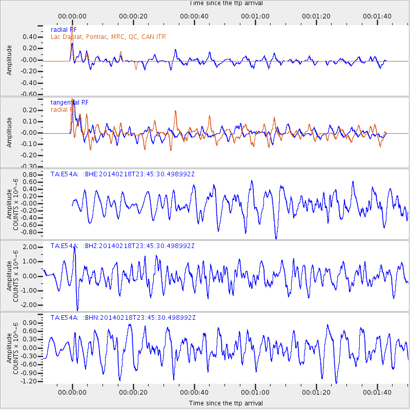
E54A Lac Daplat, Pontiac, MRC, QC, CAN - Earthquake Result Viewer
*The percent match for this event was below the threshold and hence no stack was calculated.
| Earthquake location: |
Near Coast Of Peru |
| Earthquake latitude/longitude: |
-14.2/-75.6 |
| Earthquake time(UTC): |
2014/02/18 (049) 23:35:58 GMT |
| Earthquake Depth: |
57 km |
| Earthquake Magnitude: |
6.0 MWB, 5.9 MWW, 5.9 MWC, 6.0 MWC |
| Earthquake Catalog/Contributor: |
NEIC PDE/NEIC COMCAT |
|
| Network: |
TA USArray Transportable Network (new EarthScope stations) |
| Station: |
E54A Lac Daplat, Pontiac, MRC, QC, CAN |
| Lat/Lon: |
46.43 N/77.19 W |
| Elevation: |
277 m |
|
| Distance: |
60.3 deg |
| Az: |
358.738 deg |
| Baz: |
178.231 deg |
| Ray Param: |
$rayparam |
*The percent match for this event was below the threshold and hence was not used in the summary stack. |
|
| Radial Match: |
49.604527 % |
| Radial Bump: |
398 |
| Transverse Match: |
57.728825 % |
| Transverse Bump: |
400 |
| SOD ConfigId: |
626651 |
| Insert Time: |
2014-04-20 20:09:05.127 +0000 |
| GWidth: |
2.5 |
| Max Bumps: |
400 |
| Tol: |
0.001 |
|
Signal To Noise
| Channel | StoN | STA | LTA |
| TA:E54A: :BHZ:20140218T23:45:30.498992Z | 3.0115657 | 1.0273783E-6 | 3.4114427E-7 |
| TA:E54A: :BHN:20140218T23:45:30.498992Z | 1.1413283 | 3.6612758E-7 | 3.2079075E-7 |
| TA:E54A: :BHE:20140218T23:45:30.498992Z | 0.9877157 | 2.159509E-7 | 2.186367E-7 |
| Arrivals |
| Ps | |
| PpPs | |
| PsPs/PpSs | |


