You are here: Home > Network List > TA - USArray Transportable Network (new EarthScope stations) Stations List
> Station T25A Trinidad, CO, USA > Earthquake Result Viewer
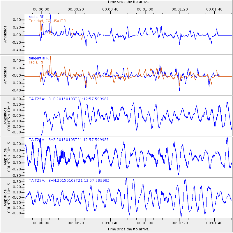
T25A Trinidad, CO, USA - Earthquake Result Viewer
*The percent match for this event was below the threshold and hence no stack was calculated.
| Earthquake location: |
Vanuatu Islands |
| Earthquake latitude/longitude: |
-17.3/168.8 |
| Earthquake time(UTC): |
2015/01/03 (003) 20:59:57 GMT |
| Earthquake Depth: |
35 km |
| Earthquake Magnitude: |
5.3 MW, 5.1 mb, 4.8 MS |
| Earthquake Catalog/Contributor: |
ISC/ISC |
|
| Network: |
TA USArray Transportable Network (new EarthScope stations) |
| Station: |
T25A Trinidad, CO, USA |
| Lat/Lon: |
37.14 N/104.41 W |
| Elevation: |
2017 m |
|
| Distance: |
97.7 deg |
| Az: |
53.619 deg |
| Baz: |
254.29 deg |
| Ray Param: |
$rayparam |
*The percent match for this event was below the threshold and hence was not used in the summary stack. |
|
| Radial Match: |
62.473427 % |
| Radial Bump: |
400 |
| Transverse Match: |
72.095024 % |
| Transverse Bump: |
339 |
| SOD ConfigId: |
3390531 |
| Insert Time: |
2019-04-15 22:20:33.640 +0000 |
| GWidth: |
2.5 |
| Max Bumps: |
400 |
| Tol: |
0.001 |
|
Signal To Noise
| Channel | StoN | STA | LTA |
| TA:T25A: :BHZ:20150103T21:12:57.59998Z | 1.2243953 | 1.6488247E-7 | 1.346644E-7 |
| TA:T25A: :BHN:20150103T21:12:57.59998Z | 1.094594 | 7.4155636E-8 | 6.774716E-8 |
| TA:T25A: :BHE:20150103T21:12:57.59998Z | 0.7916646 | 1.03098714E-7 | 1.3023029E-7 |
| Arrivals |
| Ps | |
| PpPs | |
| PsPs/PpSs | |


