You are here: Home > Network List > TA - USArray Transportable Network (new EarthScope stations) Stations List
> Station L60A Shokan, NY, USA > Earthquake Result Viewer
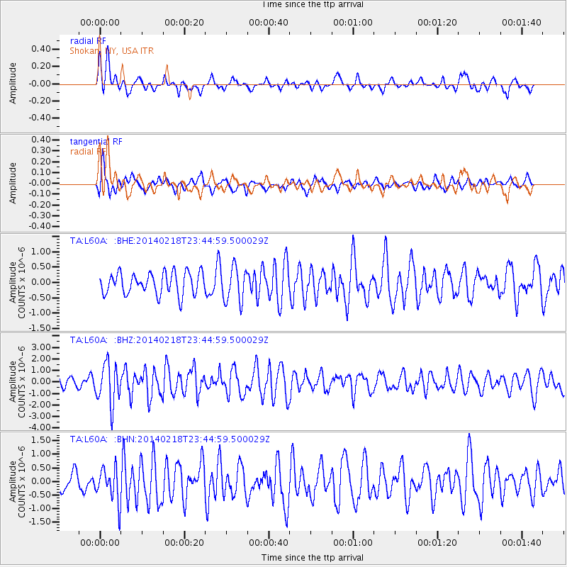
L60A Shokan, NY, USA - Earthquake Result Viewer
*The percent match for this event was below the threshold and hence no stack was calculated.
| Earthquake location: |
Near Coast Of Peru |
| Earthquake latitude/longitude: |
-14.2/-75.6 |
| Earthquake time(UTC): |
2014/02/18 (049) 23:35:58 GMT |
| Earthquake Depth: |
57 km |
| Earthquake Magnitude: |
6.0 MWB, 5.9 MWW, 5.9 MWC, 6.0 MWC |
| Earthquake Catalog/Contributor: |
NEIC PDE/NEIC COMCAT |
|
| Network: |
TA USArray Transportable Network (new EarthScope stations) |
| Station: |
L60A Shokan, NY, USA |
| Lat/Lon: |
41.99 N/74.22 W |
| Elevation: |
388 m |
|
| Distance: |
55.9 deg |
| Az: |
1.242 deg |
| Baz: |
181.616 deg |
| Ray Param: |
$rayparam |
*The percent match for this event was below the threshold and hence was not used in the summary stack. |
|
| Radial Match: |
70.62028 % |
| Radial Bump: |
400 |
| Transverse Match: |
60.060997 % |
| Transverse Bump: |
400 |
| SOD ConfigId: |
626651 |
| Insert Time: |
2014-04-20 20:14:18.923 +0000 |
| GWidth: |
2.5 |
| Max Bumps: |
400 |
| Tol: |
0.001 |
|
Signal To Noise
| Channel | StoN | STA | LTA |
| TA:L60A: :BHZ:20140218T23:44:59.500029Z | 4.053819 | 1.794661E-6 | 4.4270868E-7 |
| TA:L60A: :BHN:20140218T23:44:59.500029Z | 2.0355484 | 6.3983185E-7 | 3.14329E-7 |
| TA:L60A: :BHE:20140218T23:44:59.500029Z | 1.6180559 | 5.6915115E-7 | 3.5175E-7 |
| Arrivals |
| Ps | |
| PpPs | |
| PsPs/PpSs | |


