You are here: Home > Network List > TA - USArray Transportable Network (new EarthScope stations) Stations List
> Station U49A Red Boiling Springs, TN, USA > Earthquake Result Viewer
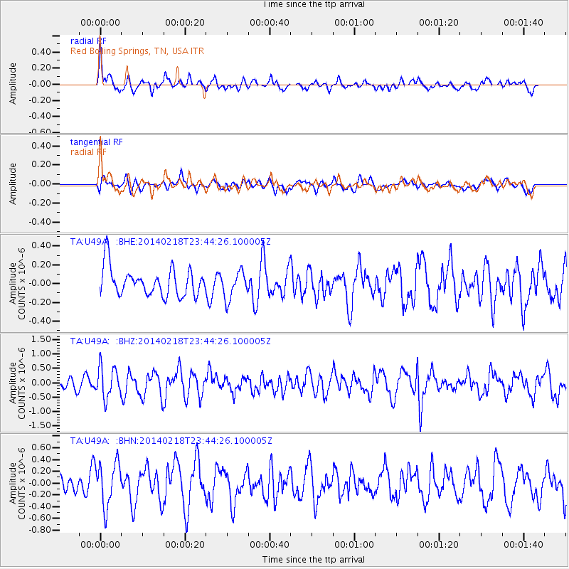
U49A Red Boiling Springs, TN, USA - Earthquake Result Viewer
*The percent match for this event was below the threshold and hence no stack was calculated.
| Earthquake location: |
Near Coast Of Peru |
| Earthquake latitude/longitude: |
-14.2/-75.6 |
| Earthquake time(UTC): |
2014/02/18 (049) 23:35:58 GMT |
| Earthquake Depth: |
57 km |
| Earthquake Magnitude: |
6.0 MWB, 5.9 MWW, 5.9 MWC, 6.0 MWC |
| Earthquake Catalog/Contributor: |
NEIC PDE/NEIC COMCAT |
|
| Network: |
TA USArray Transportable Network (new EarthScope stations) |
| Station: |
U49A Red Boiling Springs, TN, USA |
| Lat/Lon: |
36.51 N/85.78 W |
| Elevation: |
234 m |
|
| Distance: |
51.3 deg |
| Az: |
349.491 deg |
| Baz: |
167.314 deg |
| Ray Param: |
$rayparam |
*The percent match for this event was below the threshold and hence was not used in the summary stack. |
|
| Radial Match: |
51.84428 % |
| Radial Bump: |
400 |
| Transverse Match: |
58.816902 % |
| Transverse Bump: |
400 |
| SOD ConfigId: |
626651 |
| Insert Time: |
2014-04-20 20:20:54.652 +0000 |
| GWidth: |
2.5 |
| Max Bumps: |
400 |
| Tol: |
0.001 |
|
Signal To Noise
| Channel | StoN | STA | LTA |
| TA:U49A: :BHZ:20140218T23:44:26.100005Z | 3.7723806 | 5.4833487E-7 | 1.4535513E-7 |
| TA:U49A: :BHN:20140218T23:44:26.100005Z | 2.4407296 | 3.7070333E-7 | 1.5188219E-7 |
| TA:U49A: :BHE:20140218T23:44:26.100005Z | 1.019973 | 1.5015738E-7 | 1.4721702E-7 |
| Arrivals |
| Ps | |
| PpPs | |
| PsPs/PpSs | |


