You are here: Home > Network List > TA - USArray Transportable Network (new EarthScope stations) Stations List
> Station Y55A Saluda, SC, USA > Earthquake Result Viewer
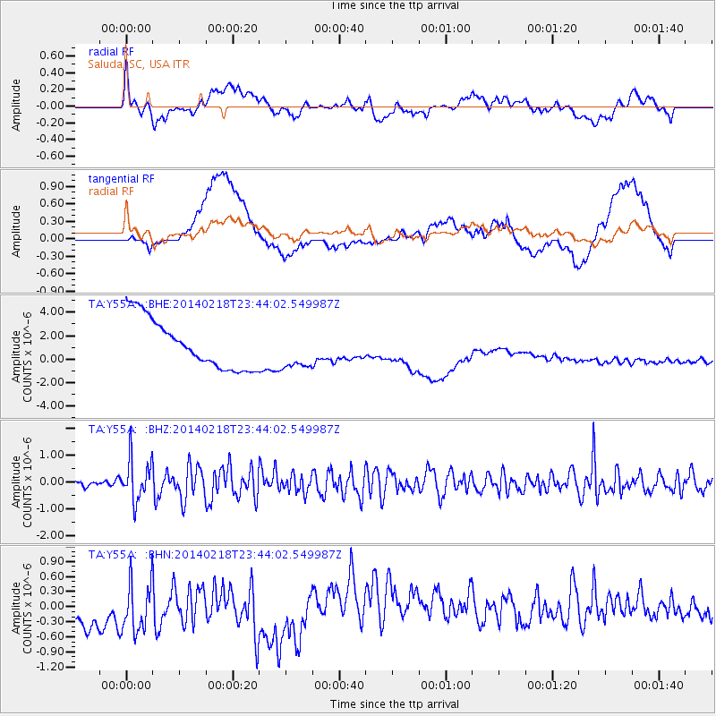
Y55A Saluda, SC, USA - Earthquake Result Viewer
*The percent match for this event was below the threshold and hence no stack was calculated.
| Earthquake location: |
Near Coast Of Peru |
| Earthquake latitude/longitude: |
-14.2/-75.6 |
| Earthquake time(UTC): |
2014/02/18 (049) 23:35:58 GMT |
| Earthquake Depth: |
57 km |
| Earthquake Magnitude: |
6.0 MWB, 5.9 MWW, 5.9 MWC, 6.0 MWC |
| Earthquake Catalog/Contributor: |
NEIC PDE/NEIC COMCAT |
|
| Network: |
TA USArray Transportable Network (new EarthScope stations) |
| Station: |
Y55A Saluda, SC, USA |
| Lat/Lon: |
33.94 N/81.86 W |
| Elevation: |
164 m |
|
| Distance: |
48.2 deg |
| Az: |
353.02 deg |
| Baz: |
171.848 deg |
| Ray Param: |
$rayparam |
*The percent match for this event was below the threshold and hence was not used in the summary stack. |
|
| Radial Match: |
38.60885 % |
| Radial Bump: |
400 |
| Transverse Match: |
16.020935 % |
| Transverse Bump: |
400 |
| SOD ConfigId: |
626651 |
| Insert Time: |
2014-04-20 20:23:27.158 +0000 |
| GWidth: |
2.5 |
| Max Bumps: |
400 |
| Tol: |
0.001 |
|
Signal To Noise
| Channel | StoN | STA | LTA |
| TA:Y55A: :BHZ:20140218T23:44:02.549987Z | 4.4829063 | 7.689383E-7 | 1.7152674E-7 |
| TA:Y55A: :BHN:20140218T23:44:02.549987Z | 0.86074084 | 6.8402977E-7 | 7.9469885E-7 |
| TA:Y55A: :BHE:20140218T23:44:02.549987Z | 0.81993675 | 1.7213756E-6 | 2.0994005E-6 |
| Arrivals |
| Ps | |
| PpPs | |
| PsPs/PpSs | |


