You are here: Home > Network List > TA - USArray Transportable Network (new EarthScope stations) Stations List
> Station Z59A Georgetown, SC, USA > Earthquake Result Viewer
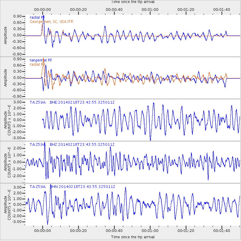
Z59A Georgetown, SC, USA - Earthquake Result Viewer
*The percent match for this event was below the threshold and hence no stack was calculated.
| Earthquake location: |
Near Coast Of Peru |
| Earthquake latitude/longitude: |
-14.2/-75.6 |
| Earthquake time(UTC): |
2014/02/18 (049) 23:35:58 GMT |
| Earthquake Depth: |
57 km |
| Earthquake Magnitude: |
6.0 MWB, 5.9 MWW, 5.9 MWC, 6.0 MWC |
| Earthquake Catalog/Contributor: |
NEIC PDE/NEIC COMCAT |
|
| Network: |
TA USArray Transportable Network (new EarthScope stations) |
| Station: |
Z59A Georgetown, SC, USA |
| Lat/Lon: |
33.24 N/79.28 W |
| Elevation: |
8.0 m |
|
| Distance: |
47.3 deg |
| Az: |
355.805 deg |
| Baz: |
175.143 deg |
| Ray Param: |
$rayparam |
*The percent match for this event was below the threshold and hence was not used in the summary stack. |
|
| Radial Match: |
78.20055 % |
| Radial Bump: |
400 |
| Transverse Match: |
73.29435 % |
| Transverse Bump: |
370 |
| SOD ConfigId: |
626651 |
| Insert Time: |
2014-04-20 20:23:54.102 +0000 |
| GWidth: |
2.5 |
| Max Bumps: |
400 |
| Tol: |
0.001 |
|
Signal To Noise
| Channel | StoN | STA | LTA |
| TA:Z59A: :BHZ:20140218T23:43:55.325011Z | 2.6293063 | 1.3111995E-6 | 4.986865E-7 |
| TA:Z59A: :BHN:20140218T23:43:55.325011Z | 2.7754161 | 1.9568322E-6 | 7.05059E-7 |
| TA:Z59A: :BHE:20140218T23:43:55.325011Z | 1.027712 | 1.0898793E-6 | 1.0604911E-6 |
| Arrivals |
| Ps | |
| PpPs | |
| PsPs/PpSs | |


