You are here: Home > Network List > US - United States National Seismic Network Stations List
> Station VBMS Vicksburg, Mississippi > Earthquake Result Viewer
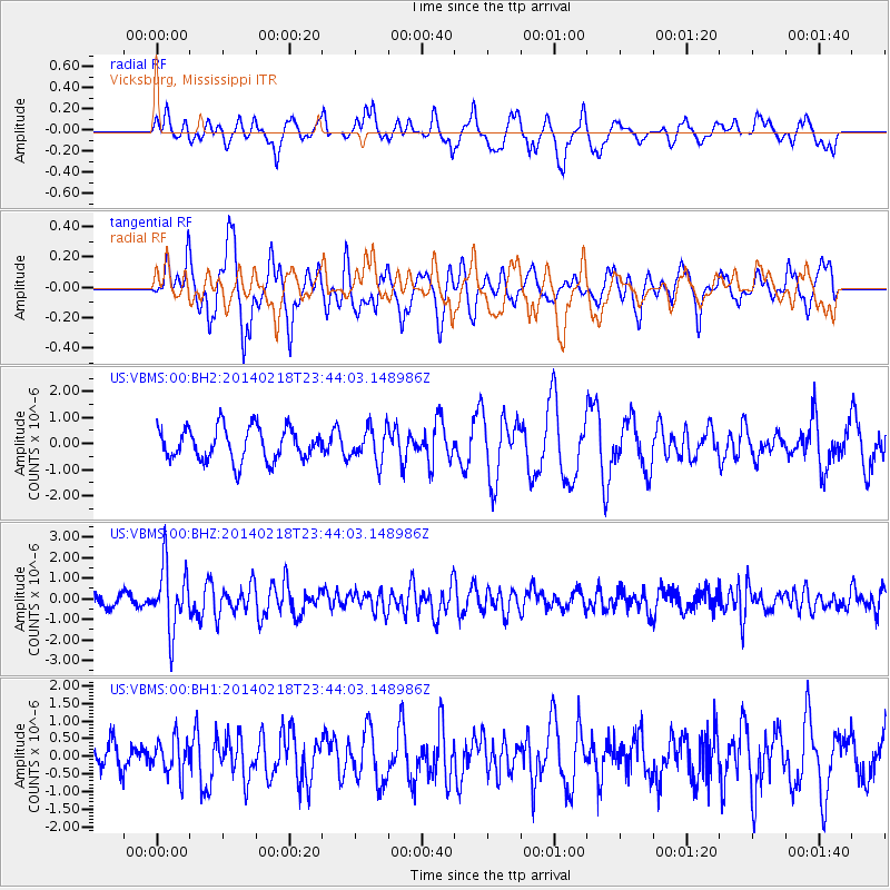
VBMS Vicksburg, Mississippi - Earthquake Result Viewer
*The percent match for this event was below the threshold and hence no stack was calculated.
| Earthquake location: |
Near Coast Of Peru |
| Earthquake latitude/longitude: |
-14.2/-75.6 |
| Earthquake time(UTC): |
2014/02/18 (049) 23:35:58 GMT |
| Earthquake Depth: |
57 km |
| Earthquake Magnitude: |
6.0 MWB, 5.9 MWW, 5.9 MWC, 6.0 MWC |
| Earthquake Catalog/Contributor: |
NEIC PDE/NEIC COMCAT |
|
| Network: |
US United States National Seismic Network |
| Station: |
VBMS Vicksburg, Mississippi |
| Lat/Lon: |
32.22 N/90.52 W |
| Elevation: |
0.0 m |
|
| Distance: |
48.3 deg |
| Az: |
343.004 deg |
| Baz: |
160.457 deg |
| Ray Param: |
$rayparam |
*The percent match for this event was below the threshold and hence was not used in the summary stack. |
|
| Radial Match: |
52.588474 % |
| Radial Bump: |
332 |
| Transverse Match: |
70.013626 % |
| Transverse Bump: |
354 |
| SOD ConfigId: |
626651 |
| Insert Time: |
2014-04-20 20:26:20.358 +0000 |
| GWidth: |
2.5 |
| Max Bumps: |
400 |
| Tol: |
0.001 |
|
Signal To Noise
| Channel | StoN | STA | LTA |
| US:VBMS:00:BHZ:20140218T23:44:03.148986Z | 5.88782 | 1.541335E-6 | 2.6178367E-7 |
| US:VBMS:00:BH1:20140218T23:44:03.148986Z | 0.7693451 | 5.0466264E-7 | 6.559639E-7 |
| US:VBMS:00:BH2:20140218T23:44:03.148986Z | 1.0127299 | 6.3265145E-7 | 6.2469906E-7 |
| Arrivals |
| Ps | |
| PpPs | |
| PsPs/PpSs | |


