You are here: Home > Network List > UW - Pacific Northwest Regional Seismic Network Stations List
> Station UMAT Pilot Rock, OR, USA > Earthquake Result Viewer
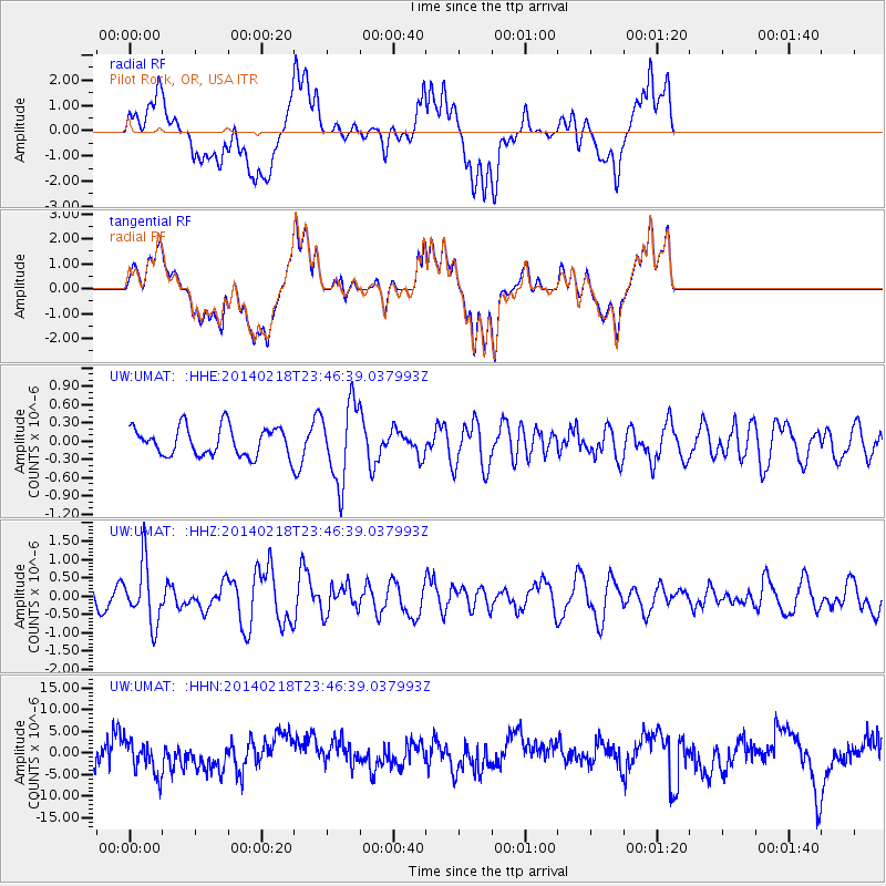
UMAT Pilot Rock, OR, USA - Earthquake Result Viewer
*The percent match for this event was below the threshold and hence no stack was calculated.
| Earthquake location: |
Near Coast Of Peru |
| Earthquake latitude/longitude: |
-14.2/-75.6 |
| Earthquake time(UTC): |
2014/02/18 (049) 23:35:58 GMT |
| Earthquake Depth: |
57 km |
| Earthquake Magnitude: |
6.0 MWB, 5.9 MWW, 5.9 MWC, 6.0 MWC |
| Earthquake Catalog/Contributor: |
NEIC PDE/NEIC COMCAT |
|
| Network: |
UW Pacific Northwest Regional Seismic Network |
| Station: |
UMAT Pilot Rock, OR, USA |
| Lat/Lon: |
45.29 N/118.96 W |
| Elevation: |
1318 m |
|
| Distance: |
71.0 deg |
| Az: |
329.165 deg |
| Baz: |
135.223 deg |
| Ray Param: |
$rayparam |
*The percent match for this event was below the threshold and hence was not used in the summary stack. |
|
| Radial Match: |
47.58939 % |
| Radial Bump: |
400 |
| Transverse Match: |
48.29302 % |
| Transverse Bump: |
400 |
| SOD ConfigId: |
626651 |
| Insert Time: |
2014-04-20 20:28:45.151 +0000 |
| GWidth: |
2.5 |
| Max Bumps: |
400 |
| Tol: |
0.001 |
|
Signal To Noise
| Channel | StoN | STA | LTA |
| UW:UMAT: :HHZ:20140218T23:46:39.037993Z | 3.4874232 | 8.1347423E-7 | 2.3325941E-7 |
| UW:UMAT: :HHN:20140218T23:46:39.037993Z | 0.7072533 | 3.7531538E-6 | 5.3066615E-6 |
| UW:UMAT: :HHE:20140218T23:46:39.037993Z | 2.7680972 | 6.4341475E-7 | 2.3243936E-7 |
| Arrivals |
| Ps | |
| PpPs | |
| PsPs/PpSs | |


