You are here: Home > Network List > CN - Canadian National Seismograph Network Stations List
> Station INK INUVIK, NT > Earthquake Result Viewer
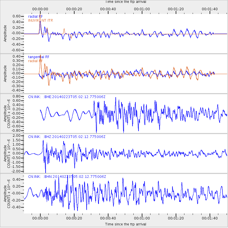
INK INUVIK, NT - Earthquake Result Viewer
*The percent match for this event was below the threshold and hence no stack was calculated.
| Earthquake location: |
Kuril Islands |
| Earthquake latitude/longitude: |
43.5/147.8 |
| Earthquake time(UTC): |
2014/02/23 (054) 04:54:18 GMT |
| Earthquake Depth: |
20 km |
| Earthquake Magnitude: |
5.5 MWC, 5.3 MWB, 5.5 MWC |
| Earthquake Catalog/Contributor: |
NEIC PDE/NEIC COMCAT |
|
| Network: |
CN Canadian National Seismograph Network |
| Station: |
INK INUVIK, NT |
| Lat/Lon: |
68.31 N/133.53 W |
| Elevation: |
44 m |
|
| Distance: |
46.4 deg |
| Az: |
30.239 deg |
| Baz: |
279.761 deg |
| Ray Param: |
$rayparam |
*The percent match for this event was below the threshold and hence was not used in the summary stack. |
|
| Radial Match: |
66.93185 % |
| Radial Bump: |
400 |
| Transverse Match: |
67.19586 % |
| Transverse Bump: |
400 |
| SOD ConfigId: |
626651 |
| Insert Time: |
2014-04-20 20:45:59.078 +0000 |
| GWidth: |
2.5 |
| Max Bumps: |
400 |
| Tol: |
0.001 |
|
Signal To Noise
| Channel | StoN | STA | LTA |
| CN:INK: :BHZ:20140223T05:02:12.775006Z | 5.4017444 | 7.3396706E-7 | 1.3587592E-7 |
| CN:INK: :BHN:20140223T05:02:12.775006Z | 0.9331674 | 9.290313E-8 | 9.9556765E-8 |
| CN:INK: :BHE:20140223T05:02:12.775006Z | 2.1401932 | 3.2865748E-7 | 1.535644E-7 |
| Arrivals |
| Ps | |
| PpPs | |
| PsPs/PpSs | |


