You are here: Home > Network List > TA - USArray Transportable Network (new EarthScope stations) Stations List
> Station G59A Clarenceville, QC, USA > Earthquake Result Viewer
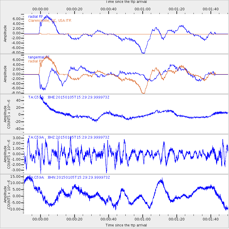
G59A Clarenceville, QC, USA - Earthquake Result Viewer
*The percent match for this event was below the threshold and hence no stack was calculated.
| Earthquake location: |
Southeast Of Honshu, Japan |
| Earthquake latitude/longitude: |
30.6/142.2 |
| Earthquake time(UTC): |
2015/01/05 (005) 15:16:27 GMT |
| Earthquake Depth: |
29 km |
| Earthquake Magnitude: |
5.2 MW, 4.9 MS, 5.3 mb |
| Earthquake Catalog/Contributor: |
ISC/ISC |
|
| Network: |
TA USArray Transportable Network (new EarthScope stations) |
| Station: |
G59A Clarenceville, QC, USA |
| Lat/Lon: |
45.08 N/73.18 W |
| Elevation: |
36 m |
|
| Distance: |
98.1 deg |
| Az: |
24.473 deg |
| Baz: |
329.726 deg |
| Ray Param: |
$rayparam |
*The percent match for this event was below the threshold and hence was not used in the summary stack. |
|
| Radial Match: |
46.289608 % |
| Radial Bump: |
400 |
| Transverse Match: |
31.182465 % |
| Transverse Bump: |
400 |
| SOD ConfigId: |
3390531 |
| Insert Time: |
2019-04-15 22:32:28.485 +0000 |
| GWidth: |
2.5 |
| Max Bumps: |
400 |
| Tol: |
0.001 |
|
Signal To Noise
| Channel | StoN | STA | LTA |
| TA:G59A: :BHZ:20150105T15:29:29.999973Z | 1.2959745 | 1.4978702E-6 | 1.1557868E-6 |
| TA:G59A: :BHN:20150105T15:29:29.999973Z | 0.5574668 | 1.2974134E-5 | 2.3273375E-5 |
| TA:G59A: :BHE:20150105T15:29:29.999973Z | 1.4615346 | 2.2172375E-5 | 1.5170612E-5 |
| Arrivals |
| Ps | |
| PpPs | |
| PsPs/PpSs | |


