You are here: Home > Network List > TA - USArray Transportable Network (new EarthScope stations) Stations List
> Station J04D Umpqua National Forest, Toketee, OR, USA > Earthquake Result Viewer
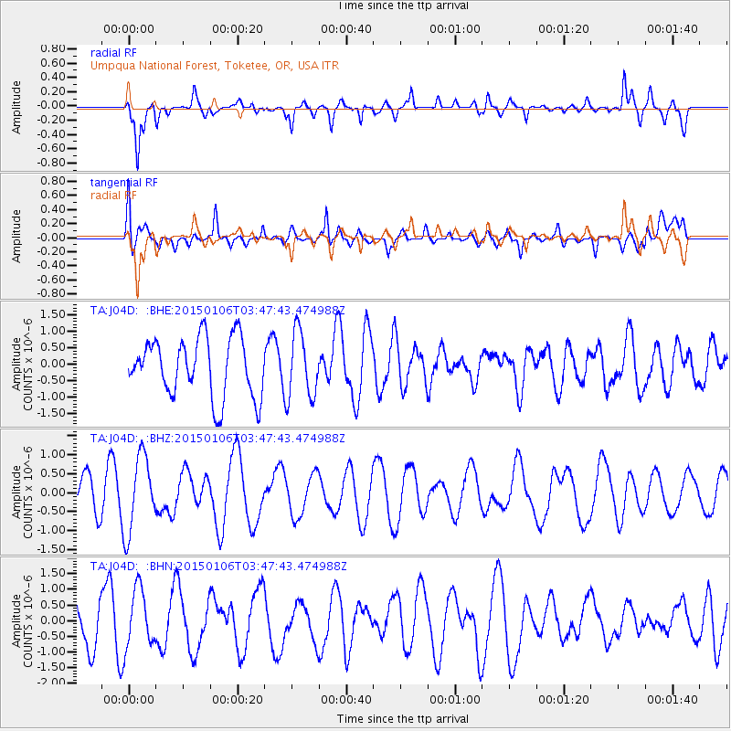
J04D Umpqua National Forest, Toketee, OR, USA - Earthquake Result Viewer
*The percent match for this event was below the threshold and hence no stack was calculated.
| Earthquake location: |
South Of Kermadec Islands |
| Earthquake latitude/longitude: |
-33.2/-179.1 |
| Earthquake time(UTC): |
2015/01/06 (006) 03:35:09 GMT |
| Earthquake Depth: |
45 km |
| Earthquake Magnitude: |
4.8 mb, 3.7 MS, 4.8 mb |
| Earthquake Catalog/Contributor: |
ISC/ISC |
|
| Network: |
TA USArray Transportable Network (new EarthScope stations) |
| Station: |
J04D Umpqua National Forest, Toketee, OR, USA |
| Lat/Lon: |
43.24 N/122.11 W |
| Elevation: |
1948 m |
|
| Distance: |
92.2 deg |
| Az: |
37.841 deg |
| Baz: |
224.737 deg |
| Ray Param: |
$rayparam |
*The percent match for this event was below the threshold and hence was not used in the summary stack. |
|
| Radial Match: |
53.65604 % |
| Radial Bump: |
400 |
| Transverse Match: |
58.624573 % |
| Transverse Bump: |
400 |
| SOD ConfigId: |
3390531 |
| Insert Time: |
2019-04-15 22:44:00.320 +0000 |
| GWidth: |
2.5 |
| Max Bumps: |
400 |
| Tol: |
0.001 |
|
Signal To Noise
| Channel | StoN | STA | LTA |
| TA:J04D: :BHZ:20150106T03:47:43.474988Z | 2.056516 | 1.0001944E-6 | 4.863538E-7 |
| TA:J04D: :BHN:20150106T03:47:43.474988Z | 1.235116 | 9.192348E-7 | 7.4424975E-7 |
| TA:J04D: :BHE:20150106T03:47:43.474988Z | 1.1210713 | 9.977333E-7 | 8.8998195E-7 |
| Arrivals |
| Ps | |
| PpPs | |
| PsPs/PpSs | |


