You are here: Home > Network List > KN - Kyrgyz Seismic Telemetry Network Stations List
> Station TKM2 - > Earthquake Result Viewer
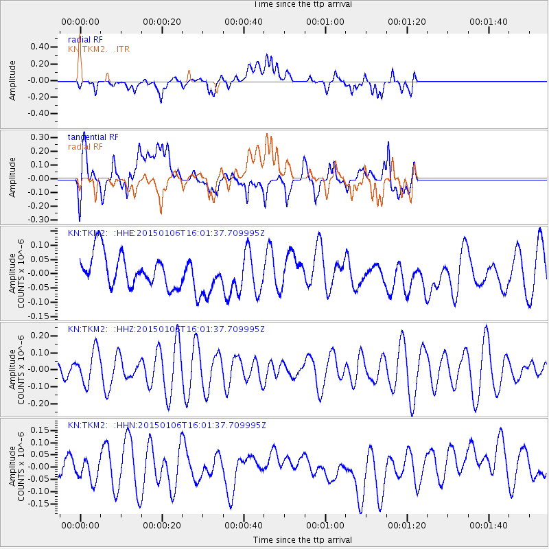
TKM2 - - Earthquake Result Viewer
*The percent match for this event was below the threshold and hence no stack was calculated.
| Earthquake location: |
Tanimbar Islands Reg., Indonesia |
| Earthquake latitude/longitude: |
-6.3/131.7 |
| Earthquake time(UTC): |
2015/01/06 (006) 15:51:04 GMT |
| Earthquake Depth: |
100 km |
| Earthquake Magnitude: |
4.5 mb, 3.6 mb |
| Earthquake Catalog/Contributor: |
ISC/ISC |
|
| Network: |
KN Kyrgyz Seismic Telemetry Network |
| Station: |
TKM2 - |
| Lat/Lon: |
42.92 N/75.60 E |
| Elevation: |
2020 m |
|
| Distance: |
70.6 deg |
| Az: |
319.708 deg |
| Baz: |
118.946 deg |
| Ray Param: |
$rayparam |
*The percent match for this event was below the threshold and hence was not used in the summary stack. |
|
| Radial Match: |
49.709305 % |
| Radial Bump: |
400 |
| Transverse Match: |
53.840096 % |
| Transverse Bump: |
400 |
| SOD ConfigId: |
3390531 |
| Insert Time: |
2019-04-15 22:47:34.946 +0000 |
| GWidth: |
2.5 |
| Max Bumps: |
400 |
| Tol: |
0.001 |
|
Signal To Noise
| Channel | StoN | STA | LTA |
| KN:TKM2: :HHZ:20150106T16:01:37.709995Z | 1.8522953 | 1.01684314E-7 | 5.4896383E-8 |
| KN:TKM2: :HHN:20150106T16:01:37.709995Z | 0.93075615 | 5.1969366E-8 | 5.583564E-8 |
| KN:TKM2: :HHE:20150106T16:01:37.709995Z | 1.2217127 | 6.94115E-8 | 5.6814912E-8 |
| Arrivals |
| Ps | |
| PpPs | |
| PsPs/PpSs | |


