You are here: Home > Network List > TA - USArray Transportable Network (new EarthScope stations) Stations List
> Station D58A Chemin du LacGrosbois, Trois-Rives, QC, CAN > Earthquake Result Viewer
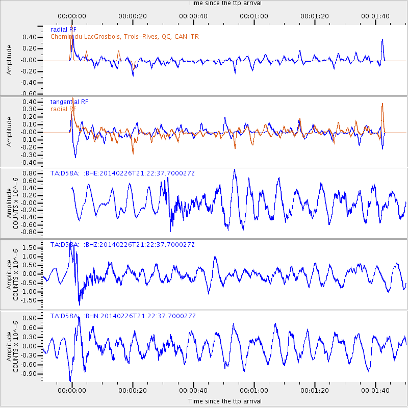
D58A Chemin du LacGrosbois, Trois-Rives, QC, CAN - Earthquake Result Viewer
*The percent match for this event was below the threshold and hence no stack was calculated.
| Earthquake location: |
Fox Islands, Aleutian Islands |
| Earthquake latitude/longitude: |
53.6/-171.8 |
| Earthquake time(UTC): |
2014/02/26 (057) 21:13:40 GMT |
| Earthquake Depth: |
265 km |
| Earthquake Magnitude: |
6.1 MWW, 5.9 MI, 5.9 ML, 6.1 MWC, 6.1 MWB, 6.2 MWC |
| Earthquake Catalog/Contributor: |
NEIC PDE/NEIC COMCAT |
|
| Network: |
TA USArray Transportable Network (new EarthScope stations) |
| Station: |
D58A Chemin du LacGrosbois, Trois-Rives, QC, CAN |
| Lat/Lon: |
47.10 N/72.88 W |
| Elevation: |
398 m |
|
| Distance: |
58.5 deg |
| Az: |
52.366 deg |
| Baz: |
316.311 deg |
| Ray Param: |
$rayparam |
*The percent match for this event was below the threshold and hence was not used in the summary stack. |
|
| Radial Match: |
52.700386 % |
| Radial Bump: |
400 |
| Transverse Match: |
57.904312 % |
| Transverse Bump: |
400 |
| SOD ConfigId: |
626651 |
| Insert Time: |
2014-04-20 22:13:56.984 +0000 |
| GWidth: |
2.5 |
| Max Bumps: |
400 |
| Tol: |
0.001 |
|
Signal To Noise
| Channel | StoN | STA | LTA |
| TA:D58A: :BHZ:20140226T21:22:37.700027Z | 4.791503 | 1.0485229E-6 | 2.1882965E-7 |
| TA:D58A: :BHN:20140226T21:22:37.700027Z | 2.528881 | 6.4098265E-7 | 2.5346492E-7 |
| TA:D58A: :BHE:20140226T21:22:37.700027Z | 1.4444598 | 3.776139E-7 | 2.6142223E-7 |
| Arrivals |
| Ps | |
| PpPs | |
| PsPs/PpSs | |


