You are here: Home > Network List > TA - USArray Transportable Network (new EarthScope stations) Stations List
> Station P48A Milroy, IN, USA > Earthquake Result Viewer
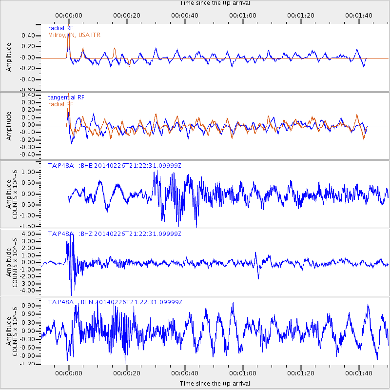
P48A Milroy, IN, USA - Earthquake Result Viewer
*The percent match for this event was below the threshold and hence no stack was calculated.
| Earthquake location: |
Fox Islands, Aleutian Islands |
| Earthquake latitude/longitude: |
53.6/-171.8 |
| Earthquake time(UTC): |
2014/02/26 (057) 21:13:40 GMT |
| Earthquake Depth: |
265 km |
| Earthquake Magnitude: |
6.1 MWW, 5.9 MI, 5.9 ML, 6.1 MWC, 6.1 MWB, 6.2 MWC |
| Earthquake Catalog/Contributor: |
NEIC PDE/NEIC COMCAT |
|
| Network: |
TA USArray Transportable Network (new EarthScope stations) |
| Station: |
P48A Milroy, IN, USA |
| Lat/Lon: |
39.46 N/85.43 W |
| Elevation: |
300 m |
|
| Distance: |
57.5 deg |
| Az: |
66.363 deg |
| Baz: |
315.154 deg |
| Ray Param: |
$rayparam |
*The percent match for this event was below the threshold and hence was not used in the summary stack. |
|
| Radial Match: |
64.27421 % |
| Radial Bump: |
400 |
| Transverse Match: |
49.278145 % |
| Transverse Bump: |
400 |
| SOD ConfigId: |
626651 |
| Insert Time: |
2014-04-20 22:23:41.773 +0000 |
| GWidth: |
2.5 |
| Max Bumps: |
400 |
| Tol: |
0.001 |
|
Signal To Noise
| Channel | StoN | STA | LTA |
| TA:P48A: :BHZ:20140226T21:22:31.09999Z | 8.556337 | 1.8763965E-6 | 2.1929904E-7 |
| TA:P48A: :BHN:20140226T21:22:31.09999Z | 2.7266347 | 5.3335E-7 | 1.9560743E-7 |
| TA:P48A: :BHE:20140226T21:22:31.09999Z | 2.2532911 | 6.3537925E-7 | 2.8197832E-7 |
| Arrivals |
| Ps | |
| PpPs | |
| PsPs/PpSs | |


