
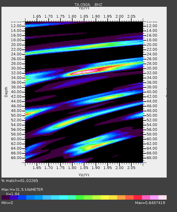
Q50A Georgetown, OH, USA - Earthquake Result Viewer
| ||||||||||||||||||
| ||||||||||||||||||
| ||||||||||||||||||
|
Signal To Noise
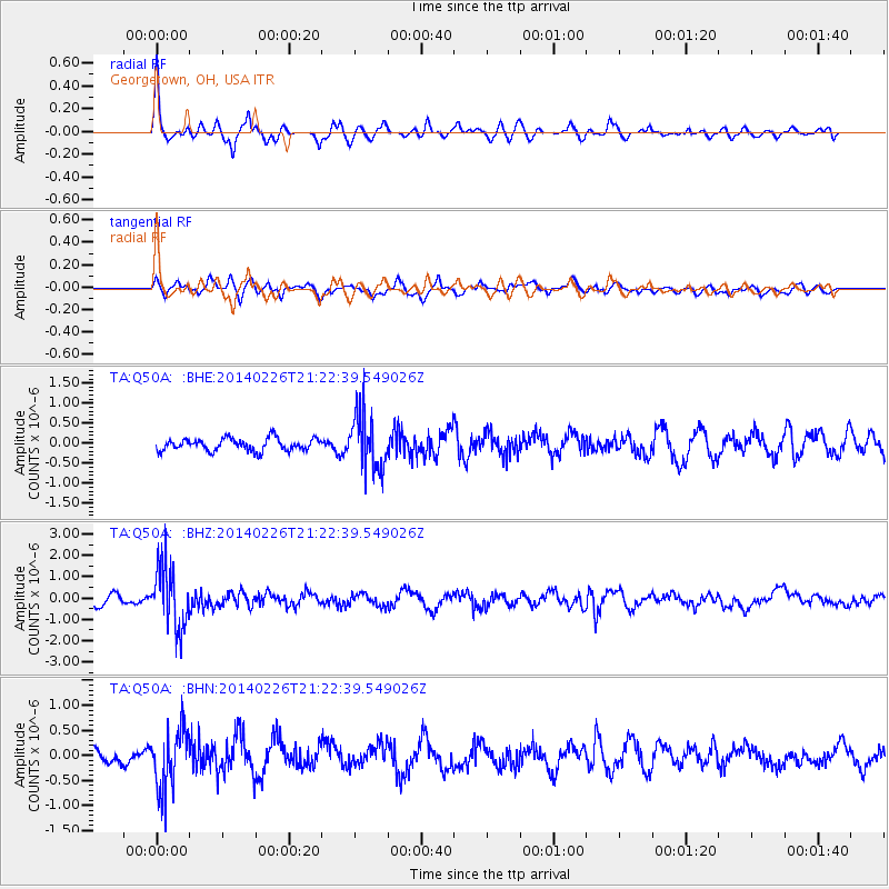
| Channel | StoN | STA | LTA |
| TA:Q50A: :BHZ:20140226T21:22:39.549026Z | 6.9173646 | 1.4547505E-6 | 2.1030415E-7 |
| TA:Q50A: :BHN:20140226T21:22:39.549026Z | 2.9036672 | 6.004422E-7 | 2.0678753E-7 |
| TA:Q50A: :BHE:20140226T21:22:39.549026Z | 4.47811 | 6.8695704E-7 | 1.5340335E-7 |
| Arrivals | |
| Ps | 4.4 SECOND |
| PpPs | 14 SECOND |
| PsPs/PpSs | 18 SECOND |

