You are here: Home > Network List > TA - USArray Transportable Network (new EarthScope stations) Stations List
> Station T60A Surry, VA, USA > Earthquake Result Viewer
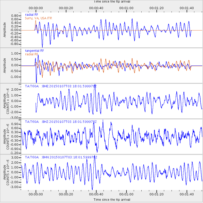
T60A Surry, VA, USA - Earthquake Result Viewer
*The percent match for this event was below the threshold and hence no stack was calculated.
| Earthquake location: |
Southeast Of Easter Island |
| Earthquake latitude/longitude: |
-35.7/-103.7 |
| Earthquake time(UTC): |
2015/01/07 (007) 03:06:41 GMT |
| Earthquake Depth: |
10 km |
| Earthquake Magnitude: |
6.0 MW, 5.2 mb, 5.5 MS |
| Earthquake Catalog/Contributor: |
ISC/ISC |
|
| Network: |
TA USArray Transportable Network (new EarthScope stations) |
| Station: |
T60A Surry, VA, USA |
| Lat/Lon: |
37.14 N/76.73 W |
| Elevation: |
11 m |
|
| Distance: |
76.7 deg |
| Az: |
21.851 deg |
| Baz: |
202.273 deg |
| Ray Param: |
$rayparam |
*The percent match for this event was below the threshold and hence was not used in the summary stack. |
|
| Radial Match: |
67.234146 % |
| Radial Bump: |
400 |
| Transverse Match: |
64.189606 % |
| Transverse Bump: |
400 |
| SOD ConfigId: |
3390531 |
| Insert Time: |
2019-04-15 23:07:11.997 +0000 |
| GWidth: |
2.5 |
| Max Bumps: |
400 |
| Tol: |
0.001 |
|
Signal To Noise
| Channel | StoN | STA | LTA |
| TA:T60A: :BHZ:20150107T03:18:01.599978Z | 0.85269856 | 3.075225E-7 | 3.606462E-7 |
| TA:T60A: :BHN:20150107T03:18:01.599978Z | 1.7399806 | 1.4198285E-6 | 8.1600257E-7 |
| TA:T60A: :BHE:20150107T03:18:01.599978Z | 0.8486933 | 7.3393846E-7 | 8.6478644E-7 |
| Arrivals |
| Ps | |
| PpPs | |
| PsPs/PpSs | |


