You are here: Home > Network List > IW - Intermountain West Stations List
> Station DLMT Dillon, Montana, USA > Earthquake Result Viewer
DLMT Dillon, Montana, USA - Earthquake Result Viewer
*The percent match for this event was below the threshold and hence no stack was calculated.
| Earthquake location: |
Bering Sea |
| Earthquake latitude/longitude: |
54.8/-172.4 |
| Earthquake time(UTC): |
2014/02/26 (057) 21:13:41 GMT |
| Earthquake Depth: |
37 km |
| Earthquake Magnitude: |
5.7 M |
| Earthquake Catalog/Contributor: |
NEIC PDE/NEIC ALERT |
|
| Network: |
IW Intermountain West |
| Station: |
DLMT Dillon, Montana, USA |
| Lat/Lon: |
45.36 N/112.60 W |
| Elevation: |
1569 m |
|
| Distance: |
38.4 deg |
| Az: |
78.744 deg |
| Baz: |
306.341 deg |
| Ray Param: |
$rayparam |
*The percent match for this event was below the threshold and hence was not used in the summary stack. |
|
| Radial Match: |
62.393017 % |
| Radial Bump: |
400 |
| Transverse Match: |
45.41713 % |
| Transverse Bump: |
400 |
| SOD ConfigId: |
626651 |
| Insert Time: |
2014-04-20 22:46:56.657 +0000 |
| GWidth: |
2.5 |
| Max Bumps: |
400 |
| Tol: |
0.001 |
|
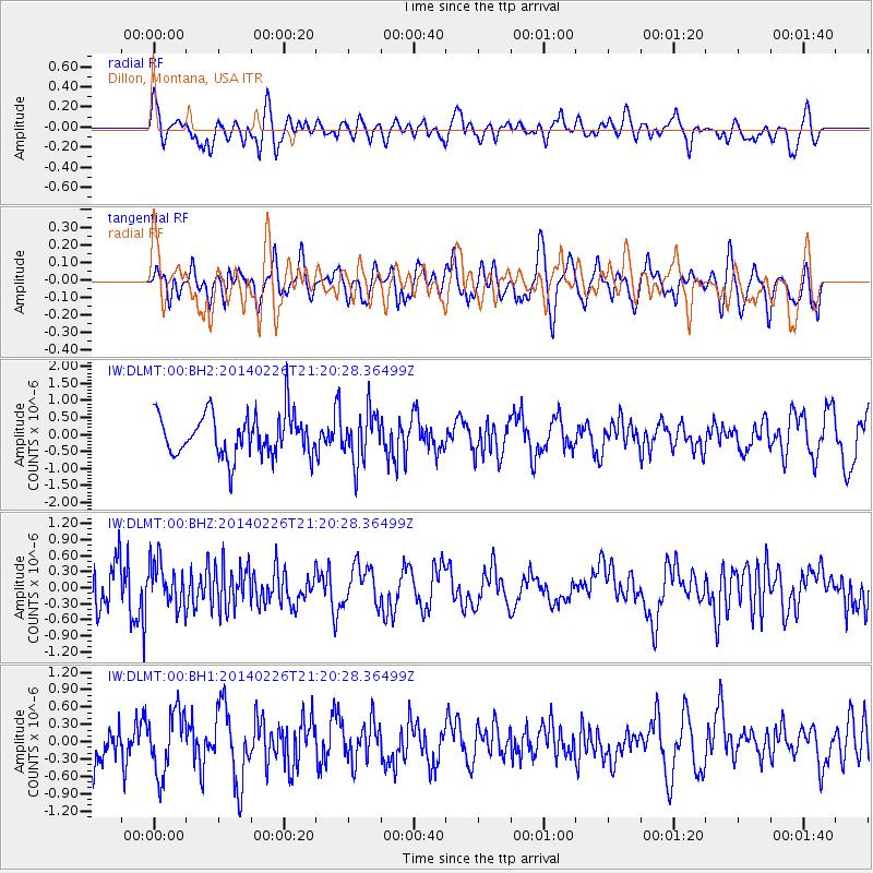
Signal To Noise
| Channel | StoN | STA | LTA |
| IW:DLMT:00:BHZ:20140226T21:20:28.36499Z | 0.6617839 | 4.0979114E-7 | 6.19222E-7 |
| IW:DLMT:00:BH1:20140226T21:20:28.36499Z | 1.55727 | 5.4101474E-7 | 3.4741225E-7 |
| IW:DLMT:00:BH2:20140226T21:20:28.36499Z | 1.190632 | 7.256769E-7 | 6.094888E-7 |
| Arrivals |
| Ps | |
| PpPs | |
| PsPs/PpSs | |


