You are here: Home > Network List > TA - USArray Transportable Network (new EarthScope stations) Stations List
> Station R55A Marlinton, WV, USA > Earthquake Result Viewer
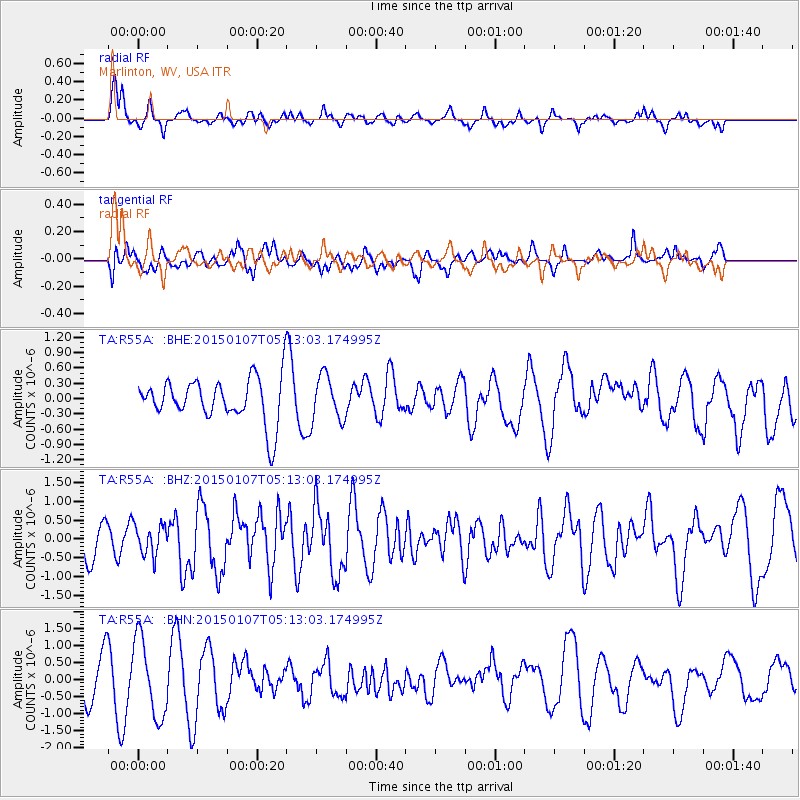
R55A Marlinton, WV, USA - Earthquake Result Viewer
*The percent match for this event was below the threshold and hence no stack was calculated.
| Earthquake location: |
South Of Panama |
| Earthquake latitude/longitude: |
5.8/-82.7 |
| Earthquake time(UTC): |
2015/01/07 (007) 05:07:08 GMT |
| Earthquake Depth: |
10 km |
| Earthquake Magnitude: |
6.6 MWP, 6.6 MI |
| Earthquake Catalog/Contributor: |
NEIC PDE/NEIC COMCAT |
|
| Network: |
TA USArray Transportable Network (new EarthScope stations) |
| Station: |
R55A Marlinton, WV, USA |
| Lat/Lon: |
38.28 N/80.12 W |
| Elevation: |
833 m |
|
| Distance: |
32.4 deg |
| Az: |
3.723 deg |
| Baz: |
184.708 deg |
| Ray Param: |
$rayparam |
*The percent match for this event was below the threshold and hence was not used in the summary stack. |
|
| Radial Match: |
62.454872 % |
| Radial Bump: |
365 |
| Transverse Match: |
59.954247 % |
| Transverse Bump: |
400 |
| SOD ConfigId: |
3390531 |
| Insert Time: |
2019-04-15 23:20:52.854 +0000 |
| GWidth: |
2.5 |
| Max Bumps: |
400 |
| Tol: |
0.001 |
|
Signal To Noise
| Channel | StoN | STA | LTA |
| TA:R55A: :BHZ:20150107T05:13:03.174995Z | 0.67175186 | 3.9390892E-7 | 5.863905E-7 |
| TA:R55A: :BHN:20150107T05:13:03.174995Z | 1.7052537 | 1.1371865E-6 | 6.6687227E-7 |
| TA:R55A: :BHE:20150107T05:13:03.174995Z | 0.6426391 | 3.4401575E-7 | 5.3531716E-7 |
| Arrivals |
| Ps | |
| PpPs | |
| PsPs/PpSs | |


