You are here: Home > Network List > US - United States National Seismic Network Stations List
> Station HAWA Hanford, Washington, USA > Earthquake Result Viewer
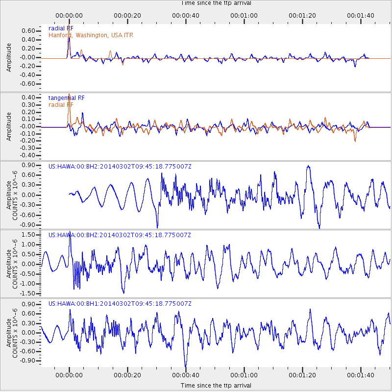
HAWA Hanford, Washington, USA - Earthquake Result Viewer
*The percent match for this event was below the threshold and hence no stack was calculated.
| Earthquake location: |
Near Coast Of Nicaragua |
| Earthquake latitude/longitude: |
12.6/-87.7 |
| Earthquake time(UTC): |
2014/03/02 (061) 09:37:54 GMT |
| Earthquake Depth: |
60 km |
| Earthquake Magnitude: |
6.2 MWW, 6.2 MWB, 6.2 MWC, 6.3 MWC |
| Earthquake Catalog/Contributor: |
NEIC PDE/NEIC COMCAT |
|
| Network: |
US United States National Seismic Network |
| Station: |
HAWA Hanford, Washington, USA |
| Lat/Lon: |
46.39 N/119.53 W |
| Elevation: |
364 m |
|
| Distance: |
43.1 deg |
| Az: |
327.703 deg |
| Baz: |
131.083 deg |
| Ray Param: |
$rayparam |
*The percent match for this event was below the threshold and hence was not used in the summary stack. |
|
| Radial Match: |
62.17268 % |
| Radial Bump: |
322 |
| Transverse Match: |
75.99741 % |
| Transverse Bump: |
400 |
| SOD ConfigId: |
626651 |
| Insert Time: |
2014-04-20 23:33:27.824 +0000 |
| GWidth: |
2.5 |
| Max Bumps: |
400 |
| Tol: |
0.001 |
|
Signal To Noise
| Channel | StoN | STA | LTA |
| US:HAWA:00:BHZ:20140302T09:45:18.775007Z | 1.7808688 | 7.116263E-7 | 3.9959502E-7 |
| US:HAWA:00:BH1:20140302T09:45:18.775007Z | 1.2705263 | 3.2148068E-7 | 2.5302955E-7 |
| US:HAWA:00:BH2:20140302T09:45:18.775007Z | 1.7681967 | 4.016805E-7 | 2.2716958E-7 |
| Arrivals |
| Ps | |
| PpPs | |
| PsPs/PpSs | |


