You are here: Home > Network List > GS - US Geological Survey Networks Stations List
> Station KAN10 Keim Farm > Earthquake Result Viewer
KAN10 Keim Farm - Earthquake Result Viewer
*The percent match for this event was below the threshold and hence no stack was calculated.
| Earthquake location: |
Pacific-Antarctic Ridge |
| Earthquake latitude/longitude: |
-54.1/-134.0 |
| Earthquake time(UTC): |
2015/01/09 (009) 00:04:55 GMT |
| Earthquake Depth: |
10 km |
| Earthquake Magnitude: |
5.3 MW, 5.0 mb, 4.9 MS |
| Earthquake Catalog/Contributor: |
ISC/ISC |
|
| Network: |
GS US Geological Survey Networks |
| Station: |
KAN10 Keim Farm |
| Lat/Lon: |
37.12 N/98.10 W |
| Elevation: |
417 m |
|
| Distance: |
96.0 deg |
| Az: |
28.115 deg |
| Baz: |
200.298 deg |
| Ray Param: |
$rayparam |
*The percent match for this event was below the threshold and hence was not used in the summary stack. |
|
| Radial Match: |
51.525143 % |
| Radial Bump: |
400 |
| Transverse Match: |
68.29341 % |
| Transverse Bump: |
400 |
| SOD ConfigId: |
3390531 |
| Insert Time: |
2019-04-15 23:49:14.555 +0000 |
| GWidth: |
2.5 |
| Max Bumps: |
400 |
| Tol: |
0.001 |
|
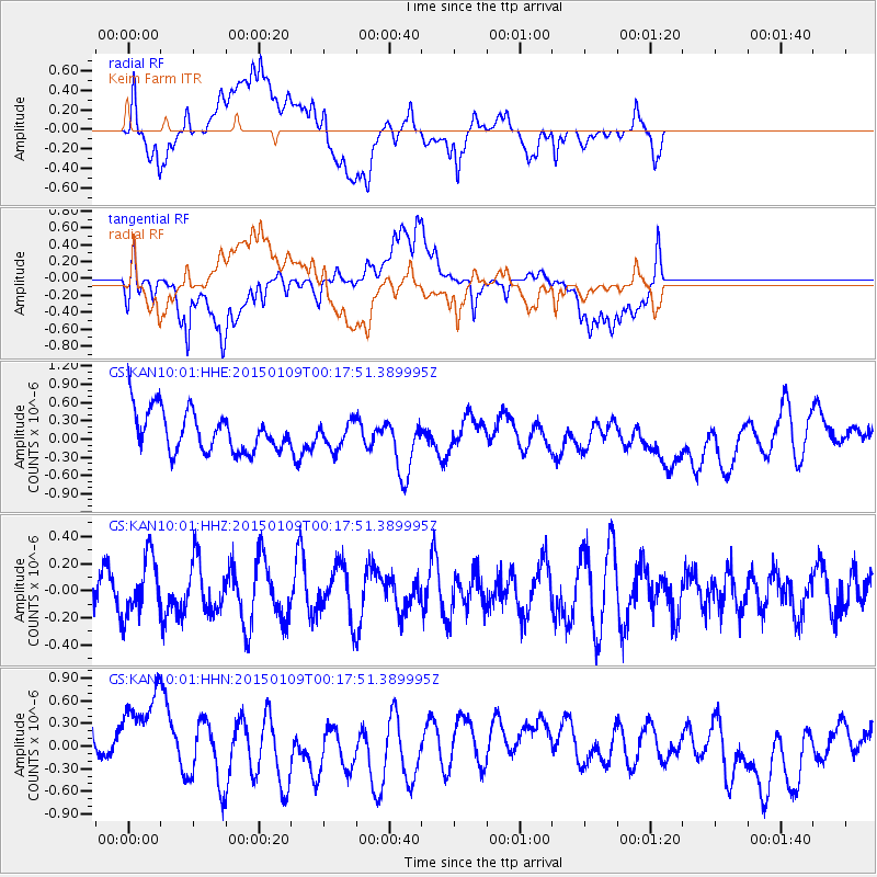
Signal To Noise
| Channel | StoN | STA | LTA |
| GS:KAN10:01:HHZ:20150109T00:17:51.389995Z | 0.8905065 | 2.153069E-7 | 2.4178024E-7 |
| GS:KAN10:01:HHN:20150109T00:17:51.389995Z | 2.4440565 | 6.65538E-7 | 2.7230874E-7 |
| GS:KAN10:01:HHE:20150109T00:17:51.389995Z | 0.65992504 | 2.2022277E-7 | 3.3370875E-7 |
| Arrivals |
| Ps | |
| PpPs | |
| PsPs/PpSs | |


