You are here: Home > Network List > II - Global Seismograph Network (GSN - IRIS/IDA) Stations List
> Station WRAB Tennant Creek, NT, Australia > Earthquake Result Viewer
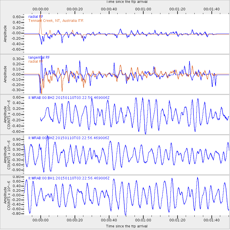
WRAB Tennant Creek, NT, Australia - Earthquake Result Viewer
*The percent match for this event was below the threshold and hence no stack was calculated.
| Earthquake location: |
Samoa Islands Region |
| Earthquake latitude/longitude: |
-15.9/-172.9 |
| Earthquake time(UTC): |
2015/01/10 (010) 03:14:35 GMT |
| Earthquake Depth: |
44 km |
| Earthquake Magnitude: |
5.1 MW, 5.1 mb, 4.2 MS |
| Earthquake Catalog/Contributor: |
ISC/ISC |
|
| Network: |
II Global Seismograph Network (GSN - IRIS/IDA) |
| Station: |
WRAB Tennant Creek, NT, Australia |
| Lat/Lon: |
19.93 S/134.36 E |
| Elevation: |
366 m |
|
| Distance: |
50.2 deg |
| Az: |
257.139 deg |
| Baz: |
94.386 deg |
| Ray Param: |
$rayparam |
*The percent match for this event was below the threshold and hence was not used in the summary stack. |
|
| Radial Match: |
62.436497 % |
| Radial Bump: |
400 |
| Transverse Match: |
54.81979 % |
| Transverse Bump: |
400 |
| SOD ConfigId: |
3390531 |
| Insert Time: |
2019-04-16 00:05:18.640 +0000 |
| GWidth: |
2.5 |
| Max Bumps: |
400 |
| Tol: |
0.001 |
|
Signal To Noise
| Channel | StoN | STA | LTA |
| II:WRAB:00:BHZ:20150110T03:22:56.469006Z | 2.1693406 | 6.5880613E-7 | 3.0368957E-7 |
| II:WRAB:00:BH1:20150110T03:22:56.469006Z | 0.38283533 | 1.619488E-7 | 4.2302472E-7 |
| II:WRAB:00:BH2:20150110T03:22:56.469006Z | 1.1870513 | 2.8523183E-7 | 2.4028603E-7 |
| Arrivals |
| Ps | |
| PpPs | |
| PsPs/PpSs | |


