You are here: Home > Network List > US - United States National Seismic Network Stations List
> Station HAWA Hanford, Washington, USA > Earthquake Result Viewer
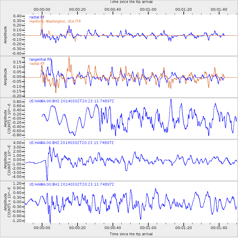
HAWA Hanford, Washington, USA - Earthquake Result Viewer
*The percent match for this event was below the threshold and hence no stack was calculated.
| Earthquake location: |
Ryukyu Islands, Japan |
| Earthquake latitude/longitude: |
27.4/127.4 |
| Earthquake time(UTC): |
2014/03/02 (061) 20:11:23 GMT |
| Earthquake Depth: |
119 km |
| Earthquake Magnitude: |
6.5 MWW, 6.4 MWB, 6.5 MWC, 6.6 MI, 6.7 MI |
| Earthquake Catalog/Contributor: |
NEIC PDE/NEIC COMCAT |
|
| Network: |
US United States National Seismic Network |
| Station: |
HAWA Hanford, Washington, USA |
| Lat/Lon: |
46.39 N/119.53 W |
| Elevation: |
364 m |
|
| Distance: |
84.9 deg |
| Az: |
39.732 deg |
| Baz: |
304.83 deg |
| Ray Param: |
$rayparam |
*The percent match for this event was below the threshold and hence was not used in the summary stack. |
|
| Radial Match: |
75.64244 % |
| Radial Bump: |
375 |
| Transverse Match: |
74.41111 % |
| Transverse Bump: |
350 |
| SOD ConfigId: |
626651 |
| Insert Time: |
2014-04-21 00:17:56.478 +0000 |
| GWidth: |
2.5 |
| Max Bumps: |
400 |
| Tol: |
0.001 |
|
Signal To Noise
| Channel | StoN | STA | LTA |
| US:HAWA:00:BHZ:20140302T20:23:13.74897Z | 3.4052637 | 1.855052E-6 | 5.4476016E-7 |
| US:HAWA:00:BH1:20140302T20:23:13.74897Z | 3.2201238 | 4.8656983E-7 | 1.5110282E-7 |
| US:HAWA:00:BH2:20140302T20:23:13.74897Z | 1.3078187 | 5.047167E-7 | 3.8592256E-7 |
| Arrivals |
| Ps | |
| PpPs | |
| PsPs/PpSs | |


