You are here: Home > Network List > UU - University of Utah Regional Network Stations List
> Station KNB Kanab, UT, USA > Earthquake Result Viewer
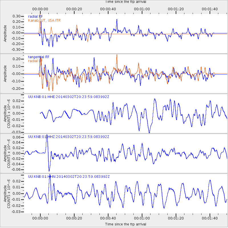
KNB Kanab, UT, USA - Earthquake Result Viewer
*The percent match for this event was below the threshold and hence no stack was calculated.
| Earthquake location: |
Ryukyu Islands, Japan |
| Earthquake latitude/longitude: |
27.4/127.4 |
| Earthquake time(UTC): |
2014/03/02 (061) 20:11:23 GMT |
| Earthquake Depth: |
119 km |
| Earthquake Magnitude: |
6.5 MWW, 6.4 MWB, 6.5 MWC, 6.6 MI, 6.7 MI |
| Earthquake Catalog/Contributor: |
NEIC PDE/NEIC COMCAT |
|
| Network: |
UU University of Utah Regional Network |
| Station: |
KNB Kanab, UT, USA |
| Lat/Lon: |
37.02 N/112.82 W |
| Elevation: |
1715 m |
|
| Distance: |
94.5 deg |
| Az: |
44.16 deg |
| Baz: |
309.319 deg |
| Ray Param: |
$rayparam |
*The percent match for this event was below the threshold and hence was not used in the summary stack. |
|
| Radial Match: |
68.23357 % |
| Radial Bump: |
400 |
| Transverse Match: |
45.097095 % |
| Transverse Bump: |
301 |
| SOD ConfigId: |
626651 |
| Insert Time: |
2014-04-21 00:18:48.586 +0000 |
| GWidth: |
2.5 |
| Max Bumps: |
400 |
| Tol: |
0.001 |
|
Signal To Noise
| Channel | StoN | STA | LTA |
| UU:KNB:01:HHZ:20140302T20:23:59.083992Z | 4.101359 | 2.6292213E-8 | 6.4106103E-9 |
| UU:KNB:01:HHN:20140302T20:23:59.083992Z | 0.9292226 | 8.014193E-9 | 8.624622E-9 |
| UU:KNB:01:HHE:20140302T20:23:59.083992Z | 1.2882334 | 6.7533303E-9 | 5.242319E-9 |
| Arrivals |
| Ps | |
| PpPs | |
| PsPs/PpSs | |


