You are here: Home > Network List > US - United States National Seismic Network Stations List
> Station AMTX Amarillo, Texas, USA > Earthquake Result Viewer
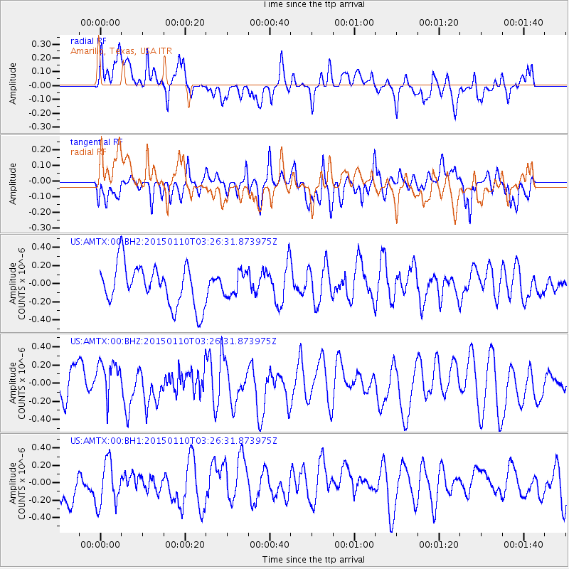
AMTX Amarillo, Texas, USA - Earthquake Result Viewer
*The percent match for this event was below the threshold and hence no stack was calculated.
| Earthquake location: |
Samoa Islands Region |
| Earthquake latitude/longitude: |
-15.9/-172.9 |
| Earthquake time(UTC): |
2015/01/10 (010) 03:14:35 GMT |
| Earthquake Depth: |
44 km |
| Earthquake Magnitude: |
5.1 MW, 5.1 mb, 4.2 MS |
| Earthquake Catalog/Contributor: |
ISC/ISC |
|
| Network: |
US United States National Seismic Network |
| Station: |
AMTX Amarillo, Texas, USA |
| Lat/Lon: |
34.53 N/101.41 W |
| Elevation: |
1010 m |
|
| Distance: |
84.4 deg |
| Az: |
51.885 deg |
| Baz: |
246.484 deg |
| Ray Param: |
$rayparam |
*The percent match for this event was below the threshold and hence was not used in the summary stack. |
|
| Radial Match: |
68.87534 % |
| Radial Bump: |
400 |
| Transverse Match: |
42.554222 % |
| Transverse Bump: |
400 |
| SOD ConfigId: |
3390531 |
| Insert Time: |
2019-04-16 00:08:14.566 +0000 |
| GWidth: |
2.5 |
| Max Bumps: |
400 |
| Tol: |
0.001 |
|
Signal To Noise
| Channel | StoN | STA | LTA |
| US:AMTX:00:BHZ:20150110T03:26:31.873975Z | 0.84579885 | 2.1153409E-7 | 2.5009973E-7 |
| US:AMTX:00:BH1:20150110T03:26:31.873975Z | 1.0295234 | 2.7202435E-7 | 2.642236E-7 |
| US:AMTX:00:BH2:20150110T03:26:31.873975Z | 0.5968952 | 1.3500657E-7 | 2.2618137E-7 |
| Arrivals |
| Ps | |
| PpPs | |
| PsPs/PpSs | |


