You are here: Home > Network List > TA - USArray Transportable Network (new EarthScope stations) Stations List
> Station G59A Clarenceville, QC, USA > Earthquake Result Viewer
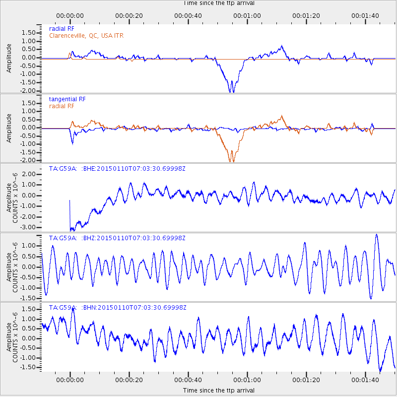
G59A Clarenceville, QC, USA - Earthquake Result Viewer
*The percent match for this event was below the threshold and hence no stack was calculated.
| Earthquake location: |
Kyrgyzstan-Xinjiang Border Reg. |
| Earthquake latitude/longitude: |
40.1/77.1 |
| Earthquake time(UTC): |
2015/01/10 (010) 06:50:57 GMT |
| Earthquake Depth: |
6.6 km |
| Earthquake Magnitude: |
5.1 MW, 5.0 mb, 4.8 MS |
| Earthquake Catalog/Contributor: |
ISC/ISC |
|
| Network: |
TA USArray Transportable Network (new EarthScope stations) |
| Station: |
G59A Clarenceville, QC, USA |
| Lat/Lon: |
45.08 N/73.18 W |
| Elevation: |
36 m |
|
| Distance: |
91.1 deg |
| Az: |
339.444 deg |
| Baz: |
22.327 deg |
| Ray Param: |
$rayparam |
*The percent match for this event was below the threshold and hence was not used in the summary stack. |
|
| Radial Match: |
16.550413 % |
| Radial Bump: |
400 |
| Transverse Match: |
48.1123 % |
| Transverse Bump: |
400 |
| SOD ConfigId: |
3390531 |
| Insert Time: |
2019-04-16 00:13:48.136 +0000 |
| GWidth: |
2.5 |
| Max Bumps: |
400 |
| Tol: |
0.001 |
|
Signal To Noise
| Channel | StoN | STA | LTA |
| TA:G59A: :BHZ:20150110T07:03:30.69998Z | 0.8882914 | 4.760247E-7 | 5.35888E-7 |
| TA:G59A: :BHN:20150110T07:03:30.69998Z | 0.90230596 | 2.1479293E-6 | 2.3804887E-6 |
| TA:G59A: :BHE:20150110T07:03:30.69998Z | 1.1086171 | 1.3906282E-6 | 1.254381E-6 |
| Arrivals |
| Ps | |
| PpPs | |
| PsPs/PpSs | |


