You are here: Home > Network List > GT - Global Telemetered Seismograph Network (USAF/USGS) Stations List
> Station LPAZ La Paz , Bolivia > Earthquake Result Viewer
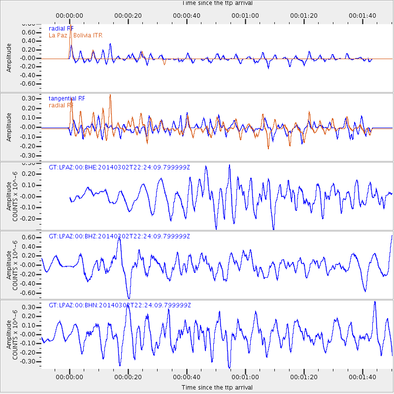
LPAZ La Paz , Bolivia - Earthquake Result Viewer
*The percent match for this event was below the threshold and hence no stack was calculated.
| Earthquake location: |
Near Coast Of Chiapas, Mexico |
| Earthquake latitude/longitude: |
14.2/-93.2 |
| Earthquake time(UTC): |
2014/03/02 (061) 22:17:14 GMT |
| Earthquake Depth: |
20 km |
| Earthquake Magnitude: |
6.0 MWC, 6.0 MWC, 6.0 MWW |
| Earthquake Catalog/Contributor: |
NEIC PDE/NEIC COMCAT |
|
| Network: |
GT Global Telemetered Seismograph Network (USAF/USGS) |
| Station: |
LPAZ La Paz , Bolivia |
| Lat/Lon: |
16.17 S/68.08 W |
| Elevation: |
4817 m |
|
| Distance: |
39.0 deg |
| Az: |
139.731 deg |
| Baz: |
319.28 deg |
| Ray Param: |
$rayparam |
*The percent match for this event was below the threshold and hence was not used in the summary stack. |
|
| Radial Match: |
58.17623 % |
| Radial Bump: |
400 |
| Transverse Match: |
53.963875 % |
| Transverse Bump: |
400 |
| SOD ConfigId: |
626651 |
| Insert Time: |
2014-04-21 00:28:52.247 +0000 |
| GWidth: |
2.5 |
| Max Bumps: |
400 |
| Tol: |
0.001 |
|
Signal To Noise
| Channel | StoN | STA | LTA |
| GT:LPAZ:00:BHZ:20140302T22:24:09.799999Z | 0.9046386 | 1.0787271E-7 | 1.1924398E-7 |
| GT:LPAZ:00:BHN:20140302T22:24:09.799999Z | 1.587345 | 9.996552E-8 | 6.2976554E-8 |
| GT:LPAZ:00:BHE:20140302T22:24:09.799999Z | 2.2330291 | 1.15018885E-7 | 5.150801E-8 |
| Arrivals |
| Ps | |
| PpPs | |
| PsPs/PpSs | |


