You are here: Home > Network List > UW - Pacific Northwest Regional Seismic Network Stations List
> Station LEBA Lebam, WA, USA > Earthquake Result Viewer
LEBA Lebam, WA, USA - Earthquake Result Viewer
*The percent match for this event was below the threshold and hence no stack was calculated.
| Earthquake location: |
Kyrgyzstan-Xinjiang Border Reg. |
| Earthquake latitude/longitude: |
40.1/77.1 |
| Earthquake time(UTC): |
2015/01/10 (010) 06:50:57 GMT |
| Earthquake Depth: |
6.6 km |
| Earthquake Magnitude: |
5.1 MW, 5.0 mb, 4.8 MS |
| Earthquake Catalog/Contributor: |
ISC/ISC |
|
| Network: |
UW Pacific Northwest Regional Seismic Network |
| Station: |
LEBA Lebam, WA, USA |
| Lat/Lon: |
46.55 N/123.56 W |
| Elevation: |
73 m |
|
| Distance: |
91.7 deg |
| Az: |
14.113 deg |
| Baz: |
344.289 deg |
| Ray Param: |
$rayparam |
*The percent match for this event was below the threshold and hence was not used in the summary stack. |
|
| Radial Match: |
56.669655 % |
| Radial Bump: |
400 |
| Transverse Match: |
46.65131 % |
| Transverse Bump: |
400 |
| SOD ConfigId: |
3390531 |
| Insert Time: |
2019-04-16 00:14:33.636 +0000 |
| GWidth: |
2.5 |
| Max Bumps: |
400 |
| Tol: |
0.001 |
|
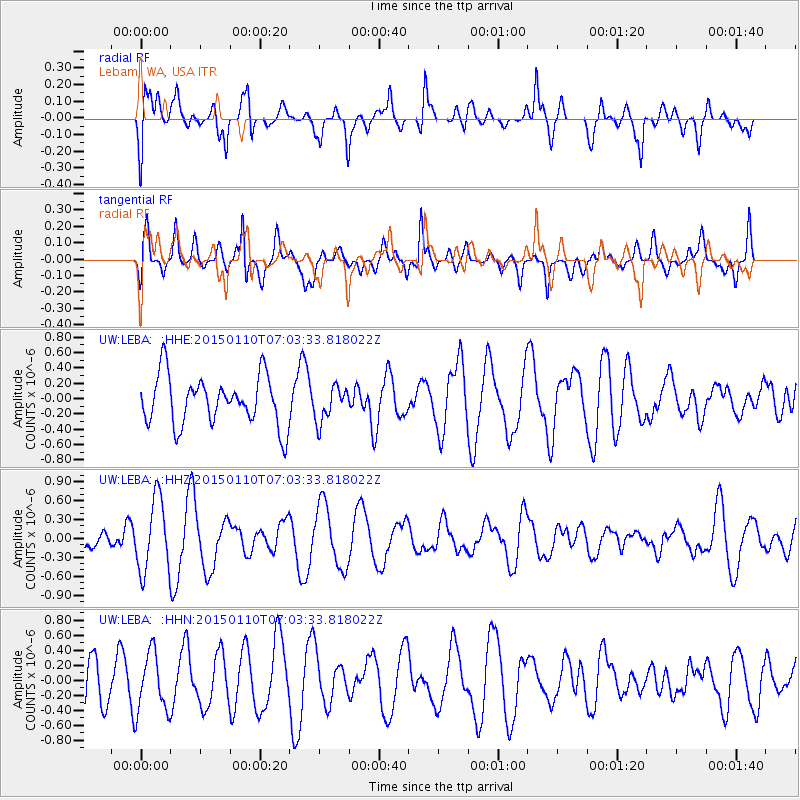
Signal To Noise
| Channel | StoN | STA | LTA |
| UW:LEBA: :HHZ:20150110T07:03:33.818022Z | 2.6500943 | 5.777582E-7 | 2.1801421E-7 |
| UW:LEBA: :HHN:20150110T07:03:33.818022Z | 1.2210591 | 3.918591E-7 | 3.209174E-7 |
| UW:LEBA: :HHE:20150110T07:03:33.818022Z | 0.69866216 | 2.255561E-7 | 3.2283998E-7 |
| Arrivals |
| Ps | |
| PpPs | |
| PsPs/PpSs | |


