You are here: Home > Network List > TA - USArray Transportable Network (new EarthScope stations) Stations List
> Station N60A Cedar Hill Farm, Mount Bethel, PA, USA > Earthquake Result Viewer
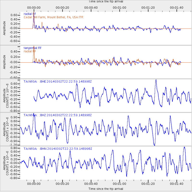
N60A Cedar Hill Farm, Mount Bethel, PA, USA - Earthquake Result Viewer
*The percent match for this event was below the threshold and hence no stack was calculated.
| Earthquake location: |
Near Coast Of Chiapas, Mexico |
| Earthquake latitude/longitude: |
14.2/-93.2 |
| Earthquake time(UTC): |
2014/03/02 (061) 22:17:14 GMT |
| Earthquake Depth: |
20 km |
| Earthquake Magnitude: |
6.0 MWC, 6.0 MWC, 6.0 MWW |
| Earthquake Catalog/Contributor: |
NEIC PDE/NEIC COMCAT |
|
| Network: |
TA USArray Transportable Network (new EarthScope stations) |
| Station: |
N60A Cedar Hill Farm, Mount Bethel, PA, USA |
| Lat/Lon: |
40.87 N/75.10 W |
| Elevation: |
189 m |
|
| Distance: |
30.9 deg |
| Az: |
27.247 deg |
| Baz: |
215.837 deg |
| Ray Param: |
$rayparam |
*The percent match for this event was below the threshold and hence was not used in the summary stack. |
|
| Radial Match: |
65.76587 % |
| Radial Bump: |
364 |
| Transverse Match: |
51.28843 % |
| Transverse Bump: |
319 |
| SOD ConfigId: |
626651 |
| Insert Time: |
2014-04-21 00:38:18.594 +0000 |
| GWidth: |
2.5 |
| Max Bumps: |
400 |
| Tol: |
0.001 |
|
Signal To Noise
| Channel | StoN | STA | LTA |
| TA:N60A: :BHZ:20140302T22:22:59.148998Z | 4.1309233 | 6.0208083E-7 | 1.457497E-7 |
| TA:N60A: :BHN:20140302T22:22:59.148998Z | 0.92827827 | 1.3057529E-7 | 1.4066396E-7 |
| TA:N60A: :BHE:20140302T22:22:59.148998Z | 3.1176686 | 3.653876E-7 | 1.1719898E-7 |
| Arrivals |
| Ps | |
| PpPs | |
| PsPs/PpSs | |


