You are here: Home > Network List > US - United States National Seismic Network Stations List
> Station DGMT Dagmar, Montana, USA > Earthquake Result Viewer
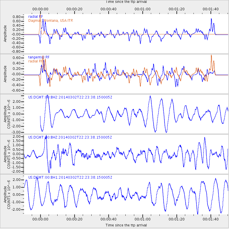
DGMT Dagmar, Montana, USA - Earthquake Result Viewer
*The percent match for this event was below the threshold and hence no stack was calculated.
| Earthquake location: |
Near Coast Of Chiapas, Mexico |
| Earthquake latitude/longitude: |
14.2/-93.2 |
| Earthquake time(UTC): |
2014/03/02 (061) 22:17:14 GMT |
| Earthquake Depth: |
20 km |
| Earthquake Magnitude: |
6.0 MWC, 6.0 MWC, 6.0 MWW |
| Earthquake Catalog/Contributor: |
NEIC PDE/NEIC COMCAT |
|
| Network: |
US United States National Seismic Network |
| Station: |
DGMT Dagmar, Montana, USA |
| Lat/Lon: |
48.47 N/104.20 W |
| Elevation: |
0.0 m |
|
| Distance: |
35.4 deg |
| Az: |
347.276 deg |
| Baz: |
161.279 deg |
| Ray Param: |
$rayparam |
*The percent match for this event was below the threshold and hence was not used in the summary stack. |
|
| Radial Match: |
60.885273 % |
| Radial Bump: |
400 |
| Transverse Match: |
61.39367 % |
| Transverse Bump: |
291 |
| SOD ConfigId: |
626651 |
| Insert Time: |
2014-04-21 00:38:58.939 +0000 |
| GWidth: |
2.5 |
| Max Bumps: |
400 |
| Tol: |
0.001 |
|
Signal To Noise
| Channel | StoN | STA | LTA |
| US:DGMT:00:BHZ:20140302T22:23:38.150005Z | 3.6787865 | 1.0338687E-6 | 2.8103526E-7 |
| US:DGMT:00:BH1:20140302T22:23:38.150005Z | 1.2416397 | 1.1121086E-6 | 8.9567743E-7 |
| US:DGMT:00:BH2:20140302T22:23:38.150005Z | 0.3652635 | 4.448554E-7 | 1.2179028E-6 |
| Arrivals |
| Ps | |
| PpPs | |
| PsPs/PpSs | |


