You are here: Home > Network List > TA - USArray Transportable Network (new EarthScope stations) Stations List
> Station R54A Victor, WV, USA > Earthquake Result Viewer
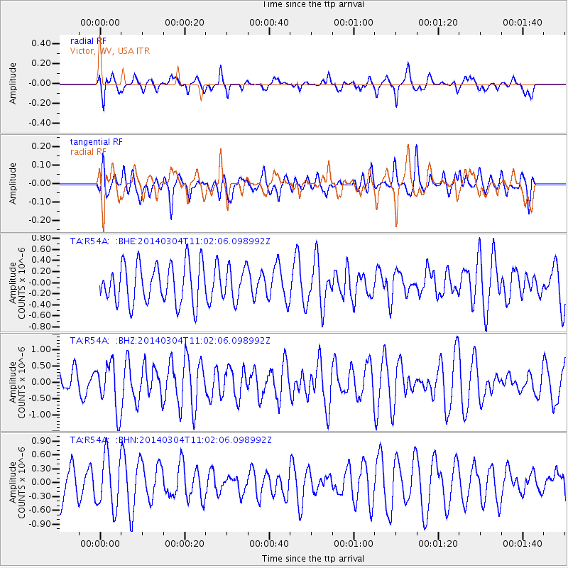
R54A Victor, WV, USA - Earthquake Result Viewer
*The percent match for this event was below the threshold and hence no stack was calculated.
| Earthquake location: |
Near Coast Of Central Chile |
| Earthquake latitude/longitude: |
-33.6/-72.0 |
| Earthquake time(UTC): |
2014/03/04 (063) 10:51:15 GMT |
| Earthquake Depth: |
20 km |
| Earthquake Magnitude: |
5.7 MWW, 5.7 MWB, 5.8 MWC |
| Earthquake Catalog/Contributor: |
NEIC PDE/NEIC COMCAT |
|
| Network: |
TA USArray Transportable Network (new EarthScope stations) |
| Station: |
R54A Victor, WV, USA |
| Lat/Lon: |
38.18 N/80.99 W |
| Elevation: |
512 m |
|
| Distance: |
71.9 deg |
| Az: |
352.521 deg |
| Baz: |
172.077 deg |
| Ray Param: |
$rayparam |
*The percent match for this event was below the threshold and hence was not used in the summary stack. |
|
| Radial Match: |
60.98884 % |
| Radial Bump: |
400 |
| Transverse Match: |
47.454422 % |
| Transverse Bump: |
400 |
| SOD ConfigId: |
626651 |
| Insert Time: |
2014-04-21 00:59:35.539 +0000 |
| GWidth: |
2.5 |
| Max Bumps: |
400 |
| Tol: |
0.001 |
|
Signal To Noise
| Channel | StoN | STA | LTA |
| TA:R54A: :BHZ:20140304T11:02:06.098992Z | 1.4799019 | 7.459473E-7 | 5.0405185E-7 |
| TA:R54A: :BHN:20140304T11:02:06.098992Z | 1.7335051 | 5.727668E-7 | 3.3040962E-7 |
| TA:R54A: :BHE:20140304T11:02:06.098992Z | 0.831274 | 2.957222E-7 | 3.5574575E-7 |
| Arrivals |
| Ps | |
| PpPs | |
| PsPs/PpSs | |


