You are here: Home > Network List > US - United States National Seismic Network Stations List
> Station EGMT Eagleton, Montana, USA > Earthquake Result Viewer
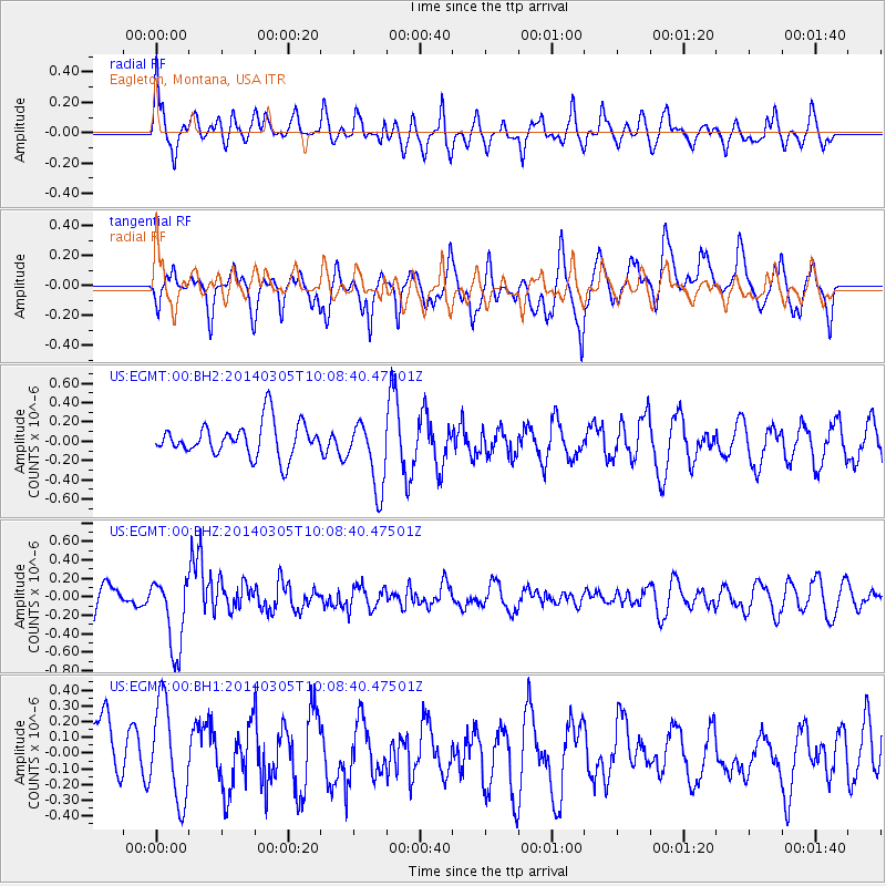
EGMT Eagleton, Montana, USA - Earthquake Result Viewer
*The percent match for this event was below the threshold and hence no stack was calculated.
| Earthquake location: |
Vanuatu Islands |
| Earthquake latitude/longitude: |
-14.7/169.8 |
| Earthquake time(UTC): |
2014/03/05 (064) 09:56:57 GMT |
| Earthquake Depth: |
638 km |
| Earthquake Magnitude: |
6.3 MWW, 6.3 MWC, 6.4 MWC, 6.4 MWB |
| Earthquake Catalog/Contributor: |
NEIC PDE/NEIC COMCAT |
|
| Network: |
US United States National Seismic Network |
| Station: |
EGMT Eagleton, Montana, USA |
| Lat/Lon: |
48.02 N/109.75 W |
| Elevation: |
1055 m |
|
| Distance: |
94.5 deg |
| Az: |
41.608 deg |
| Baz: |
253.146 deg |
| Ray Param: |
$rayparam |
*The percent match for this event was below the threshold and hence was not used in the summary stack. |
|
| Radial Match: |
41.17823 % |
| Radial Bump: |
400 |
| Transverse Match: |
64.26449 % |
| Transverse Bump: |
400 |
| SOD ConfigId: |
626651 |
| Insert Time: |
2014-04-21 01:25:03.937 +0000 |
| GWidth: |
2.5 |
| Max Bumps: |
400 |
| Tol: |
0.001 |
|
Signal To Noise
| Channel | StoN | STA | LTA |
| US:EGMT:00:BHZ:20140305T10:08:40.47501Z | 3.2969694 | 4.0180348E-7 | 1.2187056E-7 |
| US:EGMT:00:BH1:20140305T10:08:40.47501Z | 1.3002801 | 3.1309048E-7 | 2.4078696E-7 |
| US:EGMT:00:BH2:20140305T10:08:40.47501Z | 2.0495465 | 3.575574E-7 | 1.7445686E-7 |
| Arrivals |
| Ps | |
| PpPs | |
| PsPs/PpSs | |


