You are here: Home > Network List > US - United States National Seismic Network Stations List
> Station HAWA Hanford, Washington, USA > Earthquake Result Viewer
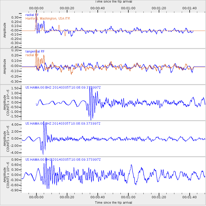
HAWA Hanford, Washington, USA - Earthquake Result Viewer
*The percent match for this event was below the threshold and hence no stack was calculated.
| Earthquake location: |
Vanuatu Islands |
| Earthquake latitude/longitude: |
-14.7/169.8 |
| Earthquake time(UTC): |
2014/03/05 (064) 09:56:57 GMT |
| Earthquake Depth: |
638 km |
| Earthquake Magnitude: |
6.3 MWW, 6.3 MWC, 6.4 MWC, 6.4 MWB |
| Earthquake Catalog/Contributor: |
NEIC PDE/NEIC COMCAT |
|
| Network: |
US United States National Seismic Network |
| Station: |
HAWA Hanford, Washington, USA |
| Lat/Lon: |
46.39 N/119.53 W |
| Elevation: |
364 m |
|
| Distance: |
87.7 deg |
| Az: |
40.808 deg |
| Baz: |
246.0 deg |
| Ray Param: |
$rayparam |
*The percent match for this event was below the threshold and hence was not used in the summary stack. |
|
| Radial Match: |
68.74898 % |
| Radial Bump: |
400 |
| Transverse Match: |
67.36415 % |
| Transverse Bump: |
381 |
| SOD ConfigId: |
626651 |
| Insert Time: |
2014-04-21 01:25:08.543 +0000 |
| GWidth: |
2.5 |
| Max Bumps: |
400 |
| Tol: |
0.001 |
|
Signal To Noise
| Channel | StoN | STA | LTA |
| US:HAWA:00:BHZ:20140305T10:08:09.373997Z | 4.87794 | 1.5803412E-6 | 3.2397713E-7 |
| US:HAWA:00:BH1:20140305T10:08:09.373997Z | 1.9725021 | 2.6657798E-7 | 1.3514713E-7 |
| US:HAWA:00:BH2:20140305T10:08:09.373997Z | 3.147944 | 5.04334E-7 | 1.602106E-7 |
| Arrivals |
| Ps | |
| PpPs | |
| PsPs/PpSs | |


