You are here: Home > Network List > UW - Pacific Northwest Regional Seismic Network Stations List
> Station MRBL Marblemount, WA, USA > Earthquake Result Viewer
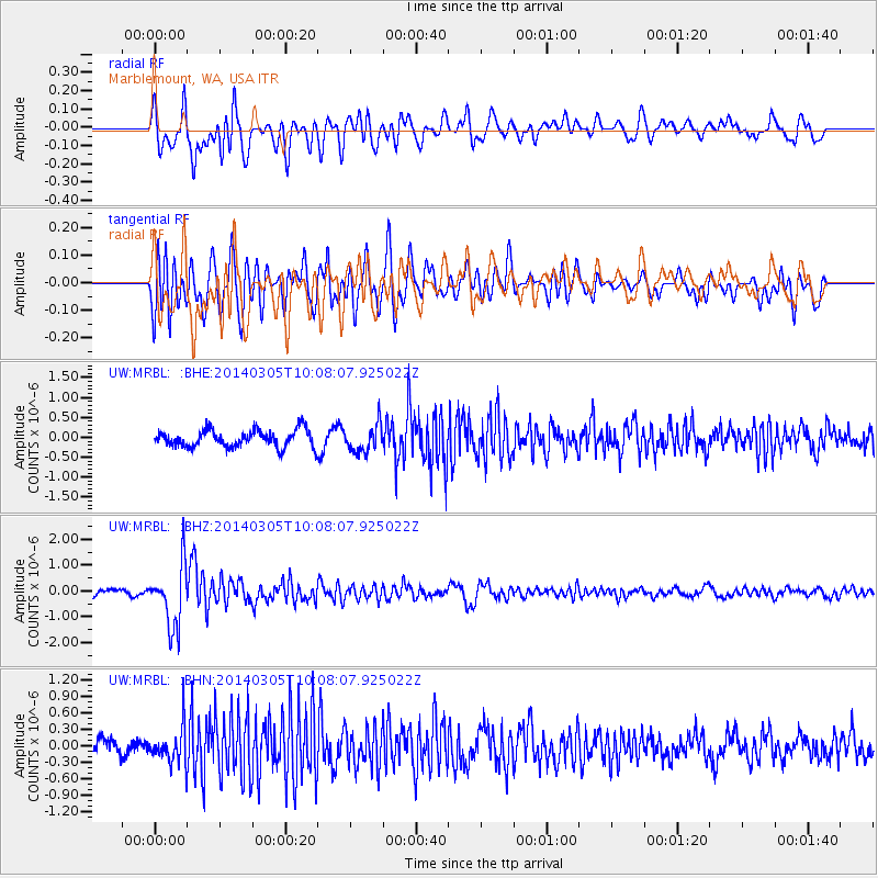
MRBL Marblemount, WA, USA - Earthquake Result Viewer
*The percent match for this event was below the threshold and hence no stack was calculated.
| Earthquake location: |
Vanuatu Islands |
| Earthquake latitude/longitude: |
-14.7/169.8 |
| Earthquake time(UTC): |
2014/03/05 (064) 09:56:57 GMT |
| Earthquake Depth: |
638 km |
| Earthquake Magnitude: |
6.3 MWW, 6.3 MWC, 6.4 MWC, 6.4 MWB |
| Earthquake Catalog/Contributor: |
NEIC PDE/NEIC COMCAT |
|
| Network: |
UW Pacific Northwest Regional Seismic Network |
| Station: |
MRBL Marblemount, WA, USA |
| Lat/Lon: |
48.52 N/121.48 W |
| Elevation: |
75 m |
|
| Distance: |
87.4 deg |
| Az: |
38.32 deg |
| Baz: |
244.461 deg |
| Ray Param: |
$rayparam |
*The percent match for this event was below the threshold and hence was not used in the summary stack. |
|
| Radial Match: |
61.67256 % |
| Radial Bump: |
400 |
| Transverse Match: |
68.091576 % |
| Transverse Bump: |
400 |
| SOD ConfigId: |
626651 |
| Insert Time: |
2014-04-21 01:27:26.544 +0000 |
| GWidth: |
2.5 |
| Max Bumps: |
400 |
| Tol: |
0.001 |
|
Signal To Noise
| Channel | StoN | STA | LTA |
| UW:MRBL: :BHZ:20140305T10:08:07.925022Z | 7.7578363 | 1.1821367E-6 | 1.5237968E-7 |
| UW:MRBL: :BHN:20140305T10:08:07.925022Z | 2.6945539 | 3.3597587E-7 | 1.2468702E-7 |
| UW:MRBL: :BHE:20140305T10:08:07.925022Z | 1.638158 | 3.4868677E-7 | 2.1285297E-7 |
| Arrivals |
| Ps | |
| PpPs | |
| PsPs/PpSs | |


