You are here: Home > Network List > US - United States National Seismic Network Stations List
> Station CBKS Cedar Bluff, Kansas, USA > Earthquake Result Viewer
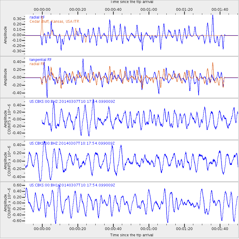
CBKS Cedar Bluff, Kansas, USA - Earthquake Result Viewer
*The percent match for this event was below the threshold and hence no stack was calculated.
| Earthquake location: |
Kermadec Islands Region |
| Earthquake latitude/longitude: |
-28.2/-176.6 |
| Earthquake time(UTC): |
2014/03/07 (066) 10:04:52 GMT |
| Earthquake Depth: |
27 km |
| Earthquake Magnitude: |
5.7 MWW, 5.5 MWB, 5.7 MWC |
| Earthquake Catalog/Contributor: |
NEIC PDE/NEIC COMCAT |
|
| Network: |
US United States National Seismic Network |
| Station: |
CBKS Cedar Bluff, Kansas, USA |
| Lat/Lon: |
38.81 N/99.74 W |
| Elevation: |
677 m |
|
| Distance: |
97.9 deg |
| Az: |
50.187 deg |
| Baz: |
240.251 deg |
| Ray Param: |
$rayparam |
*The percent match for this event was below the threshold and hence was not used in the summary stack. |
|
| Radial Match: |
51.73745 % |
| Radial Bump: |
400 |
| Transverse Match: |
64.05359 % |
| Transverse Bump: |
400 |
| SOD ConfigId: |
626651 |
| Insert Time: |
2014-04-21 02:06:16.876 +0000 |
| GWidth: |
2.5 |
| Max Bumps: |
400 |
| Tol: |
0.001 |
|
Signal To Noise
| Channel | StoN | STA | LTA |
| US:CBKS:00:BHZ:20140307T10:17:54.099009Z | 2.129063 | 3.3314706E-7 | 1.5647592E-7 |
| US:CBKS:00:BH1:20140307T10:17:54.099009Z | 1.0259249 | 2.0355753E-7 | 1.9841366E-7 |
| US:CBKS:00:BH2:20140307T10:17:54.099009Z | 0.7881815 | 1.6162365E-7 | 2.0505892E-7 |
| Arrivals |
| Ps | |
| PpPs | |
| PsPs/PpSs | |


