You are here: Home > Network List > US - United States National Seismic Network Stations List
> Station EGMT Eagleton, Montana, USA > Earthquake Result Viewer
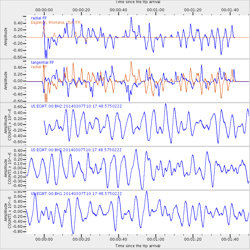
EGMT Eagleton, Montana, USA - Earthquake Result Viewer
*The percent match for this event was below the threshold and hence no stack was calculated.
| Earthquake location: |
Kermadec Islands Region |
| Earthquake latitude/longitude: |
-28.2/-176.6 |
| Earthquake time(UTC): |
2014/03/07 (066) 10:04:52 GMT |
| Earthquake Depth: |
27 km |
| Earthquake Magnitude: |
5.7 MWW, 5.5 MWB, 5.7 MWC |
| Earthquake Catalog/Contributor: |
NEIC PDE/NEIC COMCAT |
|
| Network: |
US United States National Seismic Network |
| Station: |
EGMT Eagleton, Montana, USA |
| Lat/Lon: |
48.02 N/109.75 W |
| Elevation: |
1055 m |
|
| Distance: |
96.6 deg |
| Az: |
38.43 deg |
| Baz: |
234.844 deg |
| Ray Param: |
$rayparam |
*The percent match for this event was below the threshold and hence was not used in the summary stack. |
|
| Radial Match: |
58.65863 % |
| Radial Bump: |
400 |
| Transverse Match: |
48.61393 % |
| Transverse Bump: |
400 |
| SOD ConfigId: |
626651 |
| Insert Time: |
2014-04-21 02:06:20.874 +0000 |
| GWidth: |
2.5 |
| Max Bumps: |
400 |
| Tol: |
0.001 |
|
Signal To Noise
| Channel | StoN | STA | LTA |
| US:EGMT:00:BHZ:20140307T10:17:48.575022Z | 1.870589 | 2.1915807E-7 | 1.1715993E-7 |
| US:EGMT:00:BH1:20140307T10:17:48.575022Z | 0.67949367 | 2.1082705E-7 | 3.102708E-7 |
| US:EGMT:00:BH2:20140307T10:17:48.575022Z | 0.7520923 | 1.9579423E-7 | 2.603327E-7 |
| Arrivals |
| Ps | |
| PpPs | |
| PsPs/PpSs | |


