You are here: Home > Network List > CN - Canadian National Seismograph Network Stations List
> Station INK INUVIK, NT > Earthquake Result Viewer
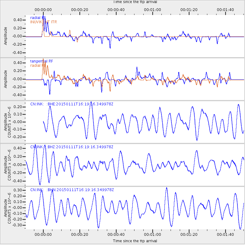
INK INUVIK, NT - Earthquake Result Viewer
*The percent match for this event was below the threshold and hence no stack was calculated.
| Earthquake location: |
Philippine Islands Region |
| Earthquake latitude/longitude: |
11.6/126.1 |
| Earthquake time(UTC): |
2015/01/11 (011) 16:07:24 GMT |
| Earthquake Depth: |
28 km |
| Earthquake Magnitude: |
4.8 mb, 4.7 mb, 4.0 MS |
| Earthquake Catalog/Contributor: |
ISC/ISC |
|
| Network: |
CN Canadian National Seismograph Network |
| Station: |
INK INUVIK, NT |
| Lat/Lon: |
68.31 N/133.53 W |
| Elevation: |
44 m |
|
| Distance: |
83.2 deg |
| Az: |
21.613 deg |
| Baz: |
283.861 deg |
| Ray Param: |
$rayparam |
*The percent match for this event was below the threshold and hence was not used in the summary stack. |
|
| Radial Match: |
68.70307 % |
| Radial Bump: |
400 |
| Transverse Match: |
56.752712 % |
| Transverse Bump: |
400 |
| SOD ConfigId: |
3390531 |
| Insert Time: |
2019-04-16 00:38:30.227 +0000 |
| GWidth: |
2.5 |
| Max Bumps: |
400 |
| Tol: |
0.001 |
|
Signal To Noise
| Channel | StoN | STA | LTA |
| CN:INK: :BHZ:20150111T16:19:16.349978Z | 2.0050824 | 3.0067505E-7 | 1.4995646E-7 |
| CN:INK: :BHN:20150111T16:19:16.349978Z | 1.063892 | 2.0867782E-7 | 1.9614569E-7 |
| CN:INK: :BHE:20150111T16:19:16.349978Z | 1.0143677 | 9.652591E-8 | 9.51587E-8 |
| Arrivals |
| Ps | |
| PpPs | |
| PsPs/PpSs | |


