You are here: Home > Network List > TA - USArray Transportable Network (new EarthScope stations) Stations List
> Station M53A WI Miller and Sons, Farmdale, OH, USA > Earthquake Result Viewer
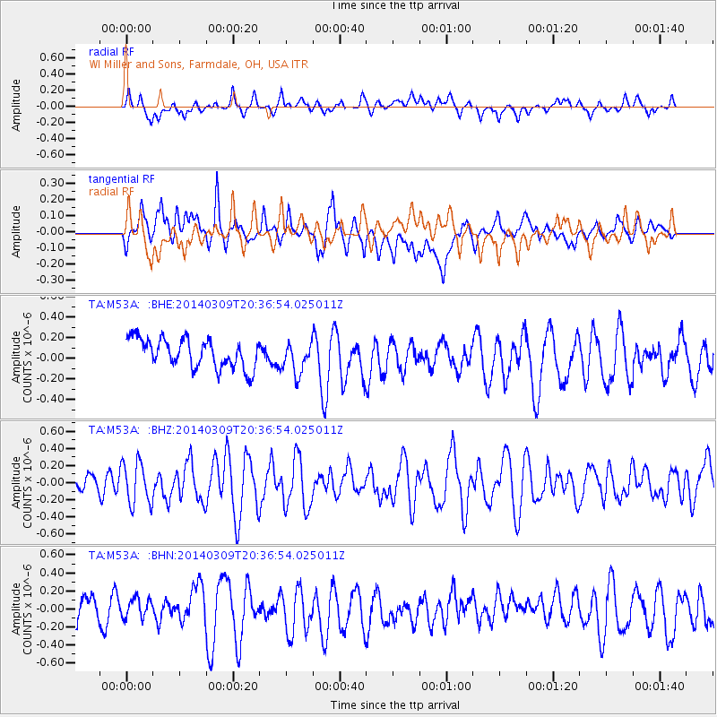
M53A WI Miller and Sons, Farmdale, OH, USA - Earthquake Result Viewer
*The percent match for this event was below the threshold and hence no stack was calculated.
| Earthquake location: |
Near Coast Of Ecuador |
| Earthquake latitude/longitude: |
1.7/-79.4 |
| Earthquake time(UTC): |
2014/03/09 (068) 20:29:52 GMT |
| Earthquake Depth: |
6.0 km |
| Earthquake Magnitude: |
5.6 MWW, 5.6 MWC, 5.6 MWB |
| Earthquake Catalog/Contributor: |
NEIC PDE/NEIC COMCAT |
|
| Network: |
TA USArray Transportable Network (new EarthScope stations) |
| Station: |
M53A WI Miller and Sons, Farmdale, OH, USA |
| Lat/Lon: |
41.44 N/80.68 W |
| Elevation: |
334 m |
|
| Distance: |
39.6 deg |
| Az: |
358.439 deg |
| Baz: |
177.924 deg |
| Ray Param: |
$rayparam |
*The percent match for this event was below the threshold and hence was not used in the summary stack. |
|
| Radial Match: |
47.81275 % |
| Radial Bump: |
400 |
| Transverse Match: |
61.900997 % |
| Transverse Bump: |
400 |
| SOD ConfigId: |
626651 |
| Insert Time: |
2014-04-21 02:25:50.270 +0000 |
| GWidth: |
2.5 |
| Max Bumps: |
400 |
| Tol: |
0.001 |
|
Signal To Noise
| Channel | StoN | STA | LTA |
| TA:M53A: :BHZ:20140309T20:36:54.025011Z | 1.4460772 | 2.486013E-7 | 1.7191428E-7 |
| TA:M53A: :BHN:20140309T20:36:54.025011Z | 0.68743134 | 1.2573406E-7 | 1.8290417E-7 |
| TA:M53A: :BHE:20140309T20:36:54.025011Z | 1.0736631 | 1.5137475E-7 | 1.4098906E-7 |
| Arrivals |
| Ps | |
| PpPs | |
| PsPs/PpSs | |


