You are here: Home > Network List > TA - USArray Transportable Network (new EarthScope stations) Stations List
> Station S49A Springfield, KY, USA > Earthquake Result Viewer
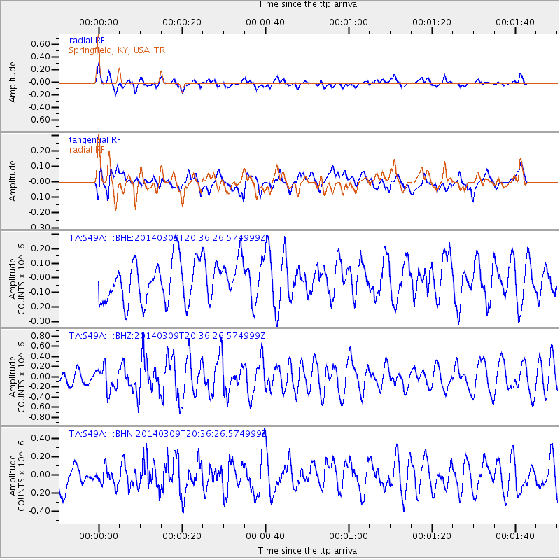
S49A Springfield, KY, USA - Earthquake Result Viewer
*The percent match for this event was below the threshold and hence no stack was calculated.
| Earthquake location: |
Near Coast Of Ecuador |
| Earthquake latitude/longitude: |
1.7/-79.4 |
| Earthquake time(UTC): |
2014/03/09 (068) 20:29:52 GMT |
| Earthquake Depth: |
6.0 km |
| Earthquake Magnitude: |
5.6 MWW, 5.6 MWC, 5.6 MWB |
| Earthquake Catalog/Contributor: |
NEIC PDE/NEIC COMCAT |
|
| Network: |
TA USArray Transportable Network (new EarthScope stations) |
| Station: |
S49A Springfield, KY, USA |
| Lat/Lon: |
37.78 N/85.29 W |
| Elevation: |
230 m |
|
| Distance: |
36.4 deg |
| Az: |
352.054 deg |
| Baz: |
169.956 deg |
| Ray Param: |
$rayparam |
*The percent match for this event was below the threshold and hence was not used in the summary stack. |
|
| Radial Match: |
63.475567 % |
| Radial Bump: |
400 |
| Transverse Match: |
45.283455 % |
| Transverse Bump: |
400 |
| SOD ConfigId: |
626651 |
| Insert Time: |
2014-04-21 02:27:39.801 +0000 |
| GWidth: |
2.5 |
| Max Bumps: |
400 |
| Tol: |
0.001 |
|
Signal To Noise
| Channel | StoN | STA | LTA |
| TA:S49A: :BHZ:20140309T20:36:26.574999Z | 1.5365809 | 2.2918094E-7 | 1.4914993E-7 |
| TA:S49A: :BHN:20140309T20:36:26.574999Z | 0.59200853 | 9.0159574E-8 | 1.5229438E-7 |
| TA:S49A: :BHE:20140309T20:36:26.574999Z | 0.91573834 | 1.3239014E-7 | 1.4457201E-7 |
| Arrivals |
| Ps | |
| PpPs | |
| PsPs/PpSs | |


