You are here: Home > Network List > TA - USArray Transportable Network (new EarthScope stations) Stations List
> Station I23K Minto, Yukon-Koyukuk, AK, USA > Earthquake Result Viewer
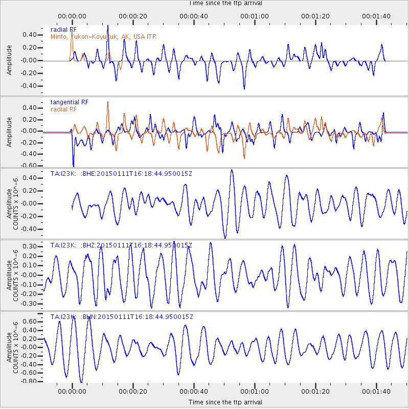
I23K Minto, Yukon-Koyukuk, AK, USA - Earthquake Result Viewer
*The percent match for this event was below the threshold and hence no stack was calculated.
| Earthquake location: |
Philippine Islands Region |
| Earthquake latitude/longitude: |
11.6/126.1 |
| Earthquake time(UTC): |
2015/01/11 (011) 16:07:24 GMT |
| Earthquake Depth: |
28 km |
| Earthquake Magnitude: |
4.8 mb, 4.7 mb, 4.0 MS |
| Earthquake Catalog/Contributor: |
ISC/ISC |
|
| Network: |
TA USArray Transportable Network (new EarthScope stations) |
| Station: |
I23K Minto, Yukon-Koyukuk, AK, USA |
| Lat/Lon: |
65.15 N/149.36 W |
| Elevation: |
149 m |
|
| Distance: |
77.3 deg |
| Az: |
25.546 deg |
| Baz: |
269.979 deg |
| Ray Param: |
$rayparam |
*The percent match for this event was below the threshold and hence was not used in the summary stack. |
|
| Radial Match: |
55.3593 % |
| Radial Bump: |
400 |
| Transverse Match: |
36.48458 % |
| Transverse Bump: |
382 |
| SOD ConfigId: |
3390531 |
| Insert Time: |
2019-04-16 00:40:06.926 +0000 |
| GWidth: |
2.5 |
| Max Bumps: |
400 |
| Tol: |
0.001 |
|
Signal To Noise
| Channel | StoN | STA | LTA |
| TA:I23K: :BHZ:20150111T16:18:44.950015Z | 1.6618418 | 1.5206348E-7 | 9.150298E-8 |
| TA:I23K: :BHN:20150111T16:18:44.950015Z | 2.2762444 | 5.1501144E-7 | 2.262549E-7 |
| TA:I23K: :BHE:20150111T16:18:44.950015Z | 0.5457263 | 7.367975E-8 | 1.3501227E-7 |
| Arrivals |
| Ps | |
| PpPs | |
| PsPs/PpSs | |


