You are here: Home > Network List > TA - USArray Transportable Network (new EarthScope stations) Stations List
> Station A04D Lummi Island, WA, USA > Earthquake Result Viewer
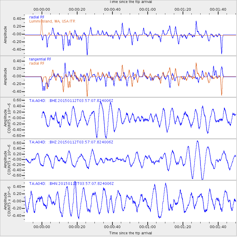
A04D Lummi Island, WA, USA - Earthquake Result Viewer
*The percent match for this event was below the threshold and hence no stack was calculated.
| Earthquake location: |
Eastern New Guinea Reg., P.N.G. |
| Earthquake latitude/longitude: |
-6.4/147.3 |
| Earthquake time(UTC): |
2015/01/12 (012) 03:44:23 GMT |
| Earthquake Depth: |
50 km |
| Earthquake Magnitude: |
4.6 mb, 4.7 mb, 4.0 MS |
| Earthquake Catalog/Contributor: |
ISC/ISC |
|
| Network: |
TA USArray Transportable Network (new EarthScope stations) |
| Station: |
A04D Lummi Island, WA, USA |
| Lat/Lon: |
48.72 N/122.71 W |
| Elevation: |
13 m |
|
| Distance: |
94.8 deg |
| Az: |
41.647 deg |
| Baz: |
265.81 deg |
| Ray Param: |
$rayparam |
*The percent match for this event was below the threshold and hence was not used in the summary stack. |
|
| Radial Match: |
44.476032 % |
| Radial Bump: |
400 |
| Transverse Match: |
46.14858 % |
| Transverse Bump: |
400 |
| SOD ConfigId: |
3390531 |
| Insert Time: |
2019-04-16 00:44:47.235 +0000 |
| GWidth: |
2.5 |
| Max Bumps: |
400 |
| Tol: |
0.001 |
|
Signal To Noise
| Channel | StoN | STA | LTA |
| TA:A04D: :BHZ:20150112T03:57:07.824006Z | 1.479535 | 1.5454724E-7 | 1.04456625E-7 |
| TA:A04D: :BHN:20150112T03:57:07.824006Z | 0.5294598 | 1.1667361E-7 | 2.2036352E-7 |
| TA:A04D: :BHE:20150112T03:57:07.824006Z | 2.3046699 | 3.9561547E-7 | 1.7165819E-7 |
| Arrivals |
| Ps | |
| PpPs | |
| PsPs/PpSs | |


