You are here: Home > Network List > CN - Canadian National Seismograph Network Stations List
> Station INK INUVIK, NT > Earthquake Result Viewer
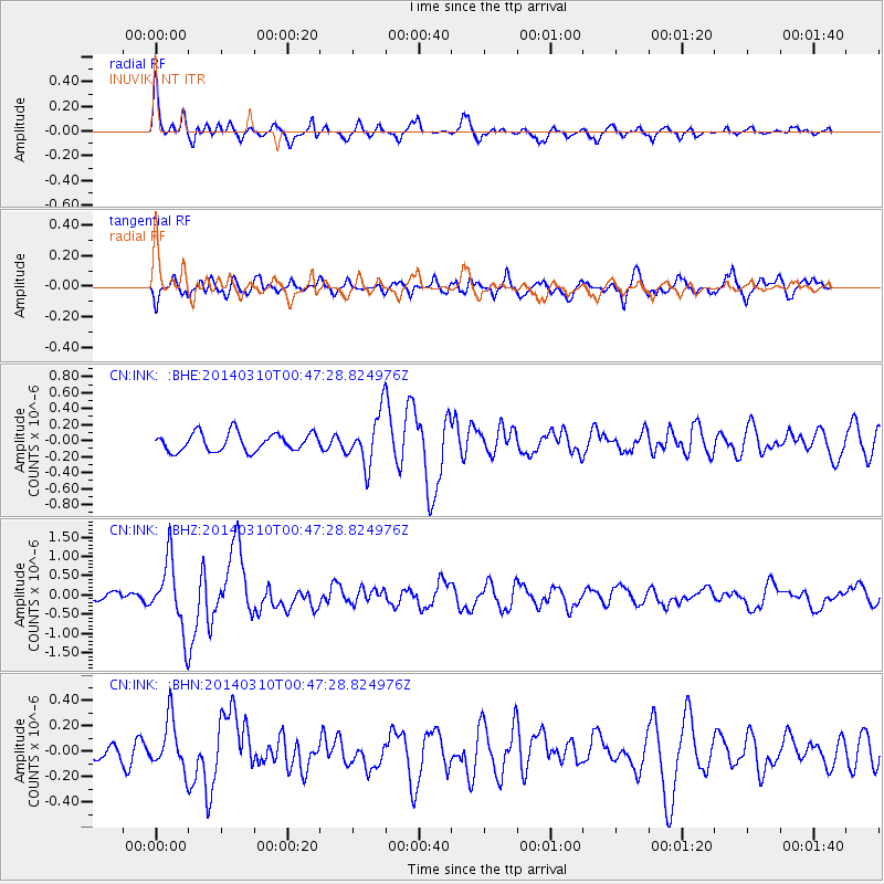
INK INUVIK, NT - Earthquake Result Viewer
*The percent match for this event was below the threshold and hence no stack was calculated.
| Earthquake location: |
Near Coast Of Guerrero, Mexico |
| Earthquake latitude/longitude: |
16.0/-98.3 |
| Earthquake time(UTC): |
2014/03/10 (069) 00:38:15 GMT |
| Earthquake Depth: |
8.4 km |
| Earthquake Magnitude: |
5.8 MWW, 5.9 MWC, 6.0 MWB |
| Earthquake Catalog/Contributor: |
NEIC PDE/NEIC COMCAT |
|
| Network: |
CN Canadian National Seismograph Network |
| Station: |
INK INUVIK, NT |
| Lat/Lon: |
68.31 N/133.53 W |
| Elevation: |
44 m |
|
| Distance: |
56.8 deg |
| Az: |
345.17 deg |
| Baz: |
138.549 deg |
| Ray Param: |
$rayparam |
*The percent match for this event was below the threshold and hence was not used in the summary stack. |
|
| Radial Match: |
79.12809 % |
| Radial Bump: |
400 |
| Transverse Match: |
67.53245 % |
| Transverse Bump: |
400 |
| SOD ConfigId: |
626651 |
| Insert Time: |
2014-04-21 02:37:51.638 +0000 |
| GWidth: |
2.5 |
| Max Bumps: |
400 |
| Tol: |
0.001 |
|
Signal To Noise
| Channel | StoN | STA | LTA |
| CN:INK: :BHZ:20140310T00:47:28.824976Z | 7.598257 | 8.9192145E-7 | 1.1738501E-7 |
| CN:INK: :BHN:20140310T00:47:28.824976Z | 1.6117678 | 2.0068916E-7 | 1.2451494E-7 |
| CN:INK: :BHE:20140310T00:47:28.824976Z | 2.8348534 | 3.2066367E-7 | 1.1311472E-7 |
| Arrivals |
| Ps | |
| PpPs | |
| PsPs/PpSs | |


