You are here: Home > Network List > UW - Pacific Northwest Regional Seismic Network Stations List
> Station PASS Maple Falls, WA, USA > Earthquake Result Viewer
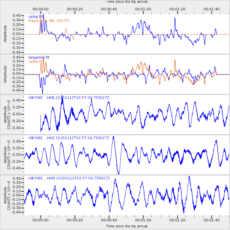
PASS Maple Falls, WA, USA - Earthquake Result Viewer
*The percent match for this event was below the threshold and hence no stack was calculated.
| Earthquake location: |
Eastern New Guinea Reg., P.N.G. |
| Earthquake latitude/longitude: |
-6.4/147.3 |
| Earthquake time(UTC): |
2015/01/12 (012) 03:44:23 GMT |
| Earthquake Depth: |
50 km |
| Earthquake Magnitude: |
4.6 mb, 4.7 mb, 4.0 MS |
| Earthquake Catalog/Contributor: |
ISC/ISC |
|
| Network: |
UW Pacific Northwest Regional Seismic Network |
| Station: |
PASS Maple Falls, WA, USA |
| Lat/Lon: |
49.00 N/122.09 W |
| Elevation: |
174 m |
|
| Distance: |
95.2 deg |
| Az: |
41.396 deg |
| Baz: |
266.298 deg |
| Ray Param: |
$rayparam |
*The percent match for this event was below the threshold and hence was not used in the summary stack. |
|
| Radial Match: |
42.61645 % |
| Radial Bump: |
400 |
| Transverse Match: |
74.69565 % |
| Transverse Bump: |
400 |
| SOD ConfigId: |
3390531 |
| Insert Time: |
2019-04-16 00:45:21.145 +0000 |
| GWidth: |
2.5 |
| Max Bumps: |
400 |
| Tol: |
0.001 |
|
Signal To Noise
| Channel | StoN | STA | LTA |
| UW:PASS: :HHZ:20150112T03:57:09.758027Z | 0.8903588 | 1.768195E-7 | 1.9859353E-7 |
| UW:PASS: :HHN:20150112T03:57:09.758027Z | 0.27485505 | 4.557325E-8 | 1.6580832E-7 |
| UW:PASS: :HHE:20150112T03:57:09.758027Z | 1.125971 | 2.4035526E-7 | 2.1346489E-7 |
| Arrivals |
| Ps | |
| PpPs | |
| PsPs/PpSs | |


