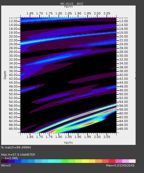
OLV2 Olveston, Montserrat - Earthquake Result Viewer

Earthquake location: Near Coast Of Guerrero, Mexico
Earthquake latitude/longitude: 16.0/-98.3
Earthquake time(UTC): 2014/03/10 (069) 00:38:15 GMT
Earthquake Depth: 8.4 km
Earthquake Magnitude: 5.8 MWW, 5.9 MWC, 6.0 MWB
Earthquake Catalog/Contributor: NEIC PDE/NEIC COMCAT
Network: MC Montserrat CALIPSO Borehole Network
Station: OLV2 Olveston, Montserrat
Lat/Lon: 16.75 N/62.23 W
Elevation: 77 m
Distance: 34.6 deg
Az: 83.649 deg
Baz: 274.098 deg
Ray Param: 0.07765236
Estimated Moho Depth: 57.5 km
Estimated Crust Vp/Vs: 2.10
Assumed Crust Vp: 6.048 km/s
Estimated Crust Vs: 2.887 km/s
Estimated Crust Poisson's Ratio: 0.35
Radial Match: 99.49994 %
Radial Bump: 48
Transverse Match: 99.99941 %
Transverse Bump: 2
SOD ConfigId: 626651
Insert Time: 2014-04-21 02:43:07.631 +0000
GWidth: 2.5
Max Bumps: 400
Tol: 0.001

Signal To Noise

ChannelStoNSTALTA
MC:OLV2: :BHZ:20140310T00:44:33.739008Z1.56726230.079350240.050629843
MC:OLV2: :BHN:20140310T00:44:33.739008Z1.56830050.60894740.38828492
MC:OLV2: :BHE:20140310T00:44:33.739008Z1.53954980.0918729160.059675187
Arrivals
Ps11 SECOND
PpPs28 SECOND
PsPs/PpSs39 SECOND