CC31 CCSE CC31 - Earthquake Result Viewer
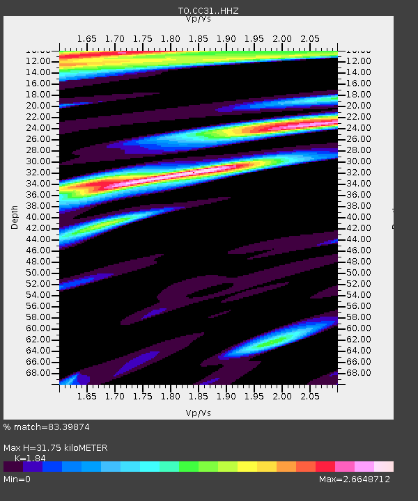
Earthquake location: Near Coast Of Chiapas, Mexico
Earthquake latitude/longitude: 15.5/-93.4
Earthquake time(UTC): 2015/01/12 (012) 07:57:27 GMT
Earthquake Depth: 75 km
Earthquake Magnitude: 5.5 MWW, 5.5 MWC, 5.5 MWB
Earthquake Catalog/Contributor: NEIC PDE/NEIC COMCAT
Network: TO Tectonic Observatory
Station: CC31 CCSE CC31
Lat/Lon: 36.32 N/119.27 W
Elevation: 93 m
Distance: 31.0 deg
Az: 316.825 deg
Baz: 125.227 deg
Ray Param: 0.0790637
Estimated Moho Depth: 31.75 km
Estimated Crust Vp/Vs: 1.84
Assumed Crust Vp: 6.291 km/s
Estimated Crust Vs: 3.419 km/s
Estimated Crust Poisson's Ratio: 0.29
Radial Match: 83.39874 %
Radial Bump: 400
Transverse Match: 61.79828 %
Transverse Bump: 400
SOD ConfigId: 3390531
Insert Time: 2019-04-16 00:50:27.208 +0000
GWidth: 2.5
Max Bumps: 400
Tol: 0.001

Signal To Noise

ChannelStoNSTALTA
TO:CC31: :HHZ:20150112T08:03:07.089989Z4.0928764.7395397E-71.1579974E-7
TO:CC31: :HHN:20150112T08:03:07.089989Z0.97494782.3710061E-72.431931E-7
TO:CC31: :HHE:20150112T08:03:07.089989Z0.701085752.048074E-72.921289E-7
Arrivals
Ps4.6 SECOND
PpPs13 SECOND
PsPs/PpSs18 SECOND