
PAGS PA Geological Survey - Earthquake Result Viewer
| ||||||||||||||||||
| ||||||||||||||||||
| ||||||||||||||||||
|
Signal To Noise
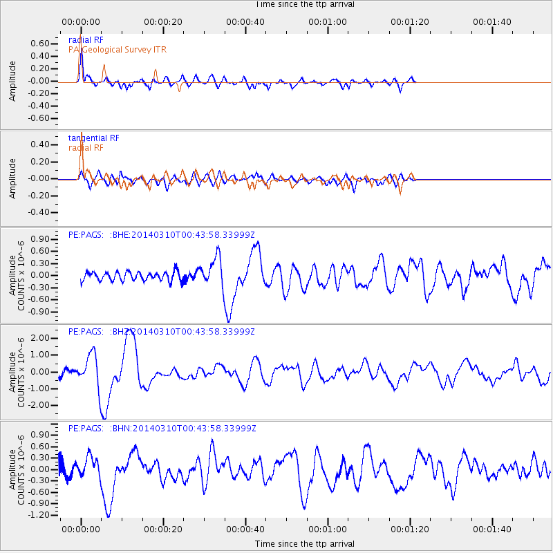
| Channel | StoN | STA | LTA |
| PE:PAGS: :BHZ:20140310T00:43:58.33999Z | 4.8804846 | 9.978097E-7 | 2.0444891E-7 |
| PE:PAGS: :BHN:20140310T00:43:58.33999Z | 1.5207855 | 2.4933058E-7 | 1.6394856E-7 |
| PE:PAGS: :BHE:20140310T00:43:58.33999Z | 3.374297 | 3.6622248E-7 | 1.0853297E-7 |
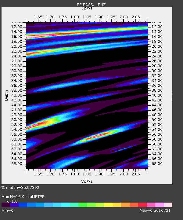
| Arrivals | |
| Ps | 1.7 SECOND |
| PpPs | 6.3 SECOND |
| PsPs/PpSs | 8.0 SECOND |

