You are here: Home > Network List > TA - USArray Transportable Network (new EarthScope stations) Stations List
> Station H45A Beulah, MI, USA > Earthquake Result Viewer
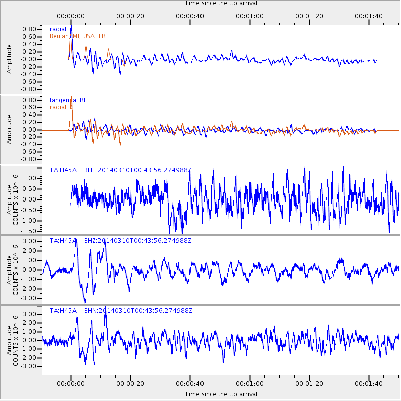
H45A Beulah, MI, USA - Earthquake Result Viewer
*The percent match for this event was below the threshold and hence no stack was calculated.
| Earthquake location: |
Near Coast Of Guerrero, Mexico |
| Earthquake latitude/longitude: |
16.0/-98.3 |
| Earthquake time(UTC): |
2014/03/10 (069) 00:38:15 GMT |
| Earthquake Depth: |
8.4 km |
| Earthquake Magnitude: |
5.8 MWW, 5.9 MWC, 6.0 MWB |
| Earthquake Catalog/Contributor: |
NEIC PDE/NEIC COMCAT |
|
| Network: |
TA USArray Transportable Network (new EarthScope stations) |
| Station: |
H45A Beulah, MI, USA |
| Lat/Lon: |
44.62 N/86.04 W |
| Elevation: |
242 m |
|
| Distance: |
30.3 deg |
| Az: |
17.522 deg |
| Baz: |
203.916 deg |
| Ray Param: |
$rayparam |
*The percent match for this event was below the threshold and hence was not used in the summary stack. |
|
| Radial Match: |
77.949165 % |
| Radial Bump: |
400 |
| Transverse Match: |
57.56806 % |
| Transverse Bump: |
400 |
| SOD ConfigId: |
626651 |
| Insert Time: |
2014-04-21 02:48:50.960 +0000 |
| GWidth: |
2.5 |
| Max Bumps: |
400 |
| Tol: |
0.001 |
|
Signal To Noise
| Channel | StoN | STA | LTA |
| TA:H45A: :BHZ:20140310T00:43:56.274988Z | 4.9693847 | 1.8495276E-6 | 3.7218445E-7 |
| TA:H45A: :BHN:20140310T00:43:56.274988Z | 3.098042 | 1.3058333E-6 | 4.2150276E-7 |
| TA:H45A: :BHE:20140310T00:43:56.274988Z | 2.0092483 | 6.670708E-7 | 3.320002E-7 |
| Arrivals |
| Ps | |
| PpPs | |
| PsPs/PpSs | |


