You are here: Home > Network List > TA - USArray Transportable Network (new EarthScope stations) Stations List
> Station H52A Wyevale, ON, CAN > Earthquake Result Viewer
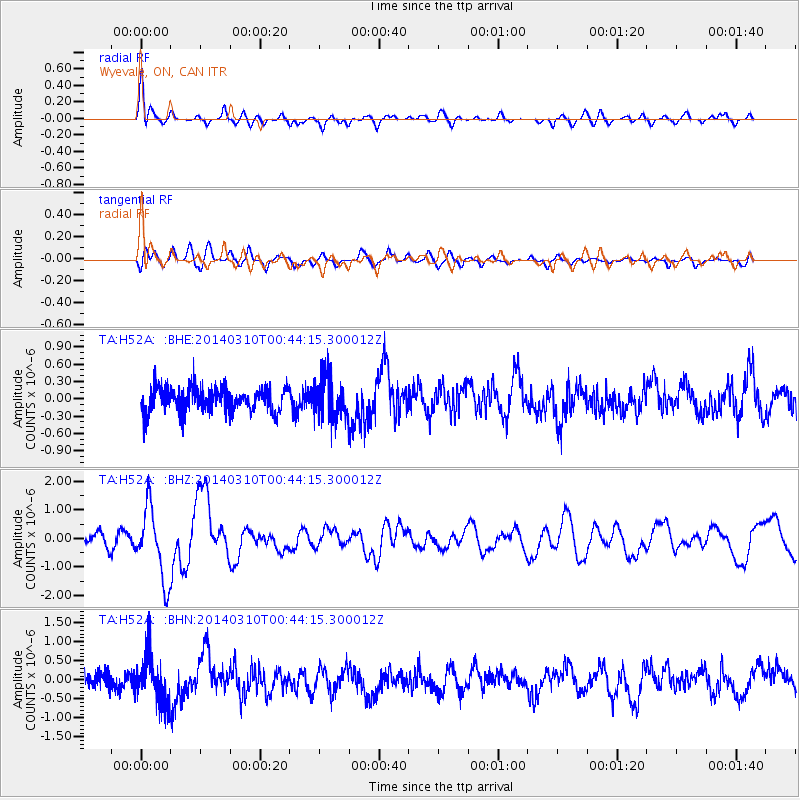
H52A Wyevale, ON, CAN - Earthquake Result Viewer
*The percent match for this event was below the threshold and hence no stack was calculated.
| Earthquake location: |
Near Coast Of Guerrero, Mexico |
| Earthquake latitude/longitude: |
16.0/-98.3 |
| Earthquake time(UTC): |
2014/03/10 (069) 00:38:15 GMT |
| Earthquake Depth: |
8.4 km |
| Earthquake Magnitude: |
5.8 MWW, 5.9 MWC, 6.0 MWB |
| Earthquake Catalog/Contributor: |
NEIC PDE/NEIC COMCAT |
|
| Network: |
TA USArray Transportable Network (new EarthScope stations) |
| Station: |
H52A Wyevale, ON, CAN |
| Lat/Lon: |
44.64 N/79.89 W |
| Elevation: |
209 m |
|
| Distance: |
32.5 deg |
| Az: |
24.866 deg |
| Baz: |
214.499 deg |
| Ray Param: |
$rayparam |
*The percent match for this event was below the threshold and hence was not used in the summary stack. |
|
| Radial Match: |
76.363884 % |
| Radial Bump: |
400 |
| Transverse Match: |
56.65028 % |
| Transverse Bump: |
400 |
| SOD ConfigId: |
626651 |
| Insert Time: |
2014-04-21 02:49:00.504 +0000 |
| GWidth: |
2.5 |
| Max Bumps: |
400 |
| Tol: |
0.001 |
|
Signal To Noise
| Channel | StoN | STA | LTA |
| TA:H52A: :BHZ:20140310T00:44:15.300012Z | 7.5219584 | 1.2600591E-6 | 1.6751743E-7 |
| TA:H52A: :BHN:20140310T00:44:15.300012Z | 2.9363148 | 6.4625834E-7 | 2.2009164E-7 |
| TA:H52A: :BHE:20140310T00:44:15.300012Z | 1.6605935 | 3.578951E-7 | 2.1552239E-7 |
| Arrivals |
| Ps | |
| PpPs | |
| PsPs/PpSs | |


