You are here: Home > Network List > TA - USArray Transportable Network (new EarthScope stations) Stations List
> Station I47A Gladwin, MI, USA > Earthquake Result Viewer
I47A Gladwin, MI, USA - Earthquake Result Viewer

| Earthquake location: |
Near Coast Of Guerrero, Mexico |
| Earthquake latitude/longitude: |
16.0/-98.3 |
| Earthquake time(UTC): |
2014/03/10 (069) 00:38:15 GMT |
| Earthquake Depth: |
8.4 km |
| Earthquake Magnitude: |
5.8 MWW, 5.9 MWC, 6.0 MWB |
| Earthquake Catalog/Contributor: |
NEIC PDE/NEIC COMCAT |
|
| Network: |
TA USArray Transportable Network (new EarthScope stations) |
| Station: |
I47A Gladwin, MI, USA |
| Lat/Lon: |
44.02 N/84.51 W |
| Elevation: |
269 m |
|
| Distance: |
30.3 deg |
| Az: |
20.008 deg |
| Baz: |
207.131 deg |
| Ray Param: |
0.0793814 |
| Estimated Moho Depth: |
44.25 km |
| Estimated Crust Vp/Vs: |
1.63 |
| Assumed Crust Vp: |
6.483 km/s |
| Estimated Crust Vs: |
3.965 km/s |
| Estimated Crust Poisson's Ratio: |
0.20 |
|
| Radial Match: |
85.361015 % |
| Radial Bump: |
400 |
| Transverse Match: |
58.399555 % |
| Transverse Bump: |
400 |
| SOD ConfigId: |
626651 |
| Insert Time: |
2014-04-21 02:49:42.880 +0000 |
| GWidth: |
2.5 |
| Max Bumps: |
400 |
| Tol: |
0.001 |
|
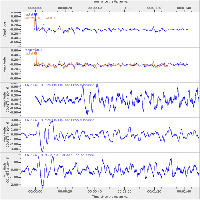
Signal To Noise
| Channel | StoN | STA | LTA |
| TA:I47A: :BHZ:20140310T00:43:55.649988Z | 6.2380066 | 1.7860843E-6 | 2.8632292E-7 |
| TA:I47A: :BHN:20140310T00:43:55.649988Z | 5.2773857 | 1.0578507E-6 | 2.0044976E-7 |
| TA:I47A: :BHE:20140310T00:43:55.649988Z | 3.3970213 | 5.0891197E-7 | 1.4981124E-7 |
| Arrivals |
| Ps | 4.7 SECOND |
| PpPs | 16 SECOND |
| PsPs/PpSs | 21 SECOND |


